Pericik geodata
Pericik (East Java) is a seat of a fourth-order administrative division; located in Indonesia in Asia/Jakarta (GMT+7) time zone. In our database, there are 407 cities with bigger population. Compared to other cities in Indonesia, 71.1% of cities are located further ↓South; 50.5% of cities are located further ←West and 66.8% of cities have higher elevation than Pericik. Note1


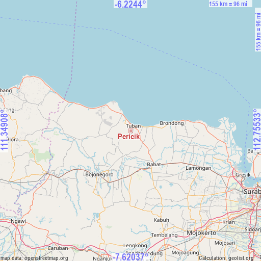
Pericik GPS coordinates[2]
6° 55' 22.44" South, 112° 3' 7.92" East
| Map corner | latitude | longitude |
|---|---|---|
| Upper-left | -6.2244°, | 111.34908° |
| Center: | -6.9229°, | 112.0522° |
| Lower-right: | -7.62037°, | 112.75533° |
| Map W x H: | 155.2×155.2 km | = 96.4×96.4mi |
| max Lat: | 5.88969° ⇑28.9% North |
| Pericik: | -6.9229° |
| min Lat: | ⇓71.1% South -10.934° |
| min Long | Pericik | max Long |
| 95.1345° | 112.0522° | 140.9419° |
| W 50.5%⇐ | ⇒49.5% E |
Elevation
Elevation of Pericik is 38 m = 125 ft, and this is 191.7 m = 629 ft below average elevation for this country.
| Max E: |
3185 m = 10449 ft | 66.8% |
| Avg. | 229.7 m = 754 ft | |
| Pericik | 38 m = 125 ft | |
Min E: |
-1 m = -3 ft | 33.2% |
See also: Indonesia elevation on elevation.city.
Geographical zone
Pericik is located in South Torrid zone (between Equator and Tropic of Capricorn). Distance of Equator is 769.8 km =478.3 mi to North.| Distance of | km | miles | from Pericik |
|---|---|---|---|
| Equator | 769.8 | 478.3 | to North |
| Tropic Capricorn | 1836.2 | 1141 | to South |
| Antarctic Circle | 6631.4 | 4120.6 | to South |
| South Pole | 9237.3 | 5739.8 | to South |


Nearby cities:
15 places around Pericik: (largest is in red/bold)
• Bandaran
0.8 km =0.5 mi,  135°
135°
• Bejagung Kidul
1.3 km =0.8 mi,  78°
78°
• Gedongombo
2 km =1.2 mi,  42°
42°
• Kajongan
3.4 km =2.1 mi,  15°
15°
• Karang
1.6 km =1 mi,  14°
14°
• Kebonsari
2.5 km =1.6 mi,  33°
33°
• Krajan Bejagung
1.5 km =0.9 mi,  58°
58°
• Krajan Prunggahan Wetan
1.7 km =1.1 mi,  190°
190°
• Kranggan
3.2 km =2 mi,  1°
1°
• Merik
2.3 km =1.4 mi,  352°
352°
• Penambangan
1.9 km =1.2 mi,  150°
150°
• Semanding Barat
1.4 km =0.9 mi,  103°
103°
• Sidomukti
2.3 km =1.4 mi, 16°
• Tegalagung
1 km =0.6 mi, 347°
• Tuban
3.1 km =1.9 mi, 26°
Sources, notices
• [Note1] Compared only with cities in Indonesia existing in our database
• [Src1] Map data: © OpenStreetMap contributors (CC-BY-SA)
• [Src2] Other city data from geonames.org with taken over terms of usage.
• [Src3] Geographical zone / Annual Mean Temperature by Robert A. Rohde @ Wikipedia
