Bakung geodata
Bakung (East Java) is a seat of a third-order administrative division; located in Indonesia in Asia/Jakarta (GMT+7) time zone. In our database, there are 407 cities with bigger population. Compared to other cities in Indonesia, 74.7% of cities are located further ↑North; 50.8% of cities are located further ←West and 54.8% of cities have lower elevation than Bakung. Note1


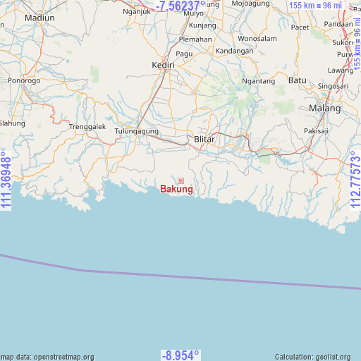
Bakung GPS coordinates[2]
8° 15' 31.68" South, 112° 4' 21.36" East
| Map corner | latitude | longitude |
|---|---|---|
| Upper-left | -7.56237°, | 111.36948° |
| Center: | -8.2588°, | 112.0726° |
| Lower-right: | -8.954°, | 112.77573° |
| Map W x H: | 154.7×154.7 km | = 96.1×96.1mi |
| max Lat: | 5.88969° ⇑74.7% North |
| Bakung: | -8.2588° |
| min Lat: | ⇓25.3% South -10.934° |
| min Long | Bakung | max Long |
| 95.1345° | 112.0726° | 140.9419° |
| W 50.8%⇐ | ⇒49.2% E |
Elevation
Elevation of Bakung is 124 m = 407 ft, and this is 105.7 m = 347 ft below average elevation for this country.
| Max E: |
3185 m = 10449 ft | 45.2% |
| Avg. | 229.7 m = 754 ft | |
| Bakung | 124 m = 407 ft | |
Min E: |
-1 m = -3 ft | 54.8% |
See also: Indonesia elevation on elevation.city.
Geographical zone
Bakung is located in South Torrid zone (between Equator and Tropic of Capricorn). Distance of Equator is 918.3 km =570.6 mi to North.| Distance of | km | miles | from Bakung |
|---|---|---|---|
| Equator | 918.3 | 570.6 | to North |
| Tropic Capricorn | 1687.6 | 1048.6 | to South |
| Antarctic Circle | 6482.9 | 4028.3 | to South |
| South Pole | 9088.8 | 5647.5 | to South |


Nearby cities:
15 places around Bakung: (largest is in red/bold)
• Apakbranjang
6 km =3.7 mi,  261°
261°
• Bakung Utara
0.6 km =0.4 mi,  336°
336°
• Bendosari
6.2 km =3.9 mi,  38°
38°
• Kalimeneng
3.4 km =2.1 mi,  145°
145°
• Kedungbanteng
3.2 km =2 mi, 43°
• Kedunggajul
3 km =1.9 mi,  172°
172°
• Lorejo
5.8 km =3.6 mi,  61°
61°
• Miribanteng
5.6 km =3.5 mi,  297°
297°
• Ngrejo
2.4 km =1.5 mi,  22°
22°
• Pakisaji
5.1 km =3.2 mi, 339°
• Plandirejo
4.5 km =2.8 mi, 258°
• Pucanglaban
6.3 km =3.9 mi,  266°
266°
• Sumberdadi
1 km =0.6 mi,  252°
252°
• Tumpakkepuh
5.2 km =3.2 mi,  133°
133°
• Tumpakoyot
3.7 km =2.3 mi, 249°
Sources, notices
• [Note1] Compared only with cities in Indonesia existing in our database
• [Src1] Map data: © OpenStreetMap contributors (CC-BY-SA)
• [Src2] Other city data from geonames.org with taken over terms of usage.
• [Src3] Geographical zone / Annual Mean Temperature by Robert A. Rohde @ Wikipedia
