Tanjung Kidul geodata
Tanjung Kidul (East Java) is a seat of a fourth-order administrative division; located in Indonesia in Asia/Jakarta (GMT+7) time zone. In our database, there are 407 cities with bigger population. Compared to other cities in Indonesia, 59.9% of cities are located further ↑North; 62.2% of cities are located further ←West and 85.2% of cities have higher elevation than Tanjung Kidul. Note1


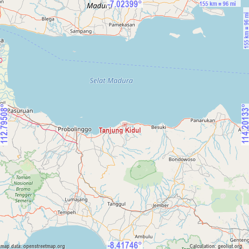
Tanjung Kidul GPS coordinates[2]
7° 43' 16.68" South, 113° 29' 53.52" East
| Map corner | latitude | longitude |
|---|---|---|
| Upper-left | -7.02399°, | 112.79508° |
| Center: | -7.7213°, | 113.4982° |
| Lower-right: | -8.41746°, | 114.20133° |
| Map W x H: | 154.9×154.9 km | = 96.3×96.3mi |
| max Lat: | 5.88969° ⇑59.9% North |
| Tanjung Kidul: | -7.7213° |
| min Lat: | ⇓40.1% South -10.934° |
| min Long | Tanjung Kidul | max Long |
| 95.1345° | 113.4982° | 140.9419° |
| W 62.2%⇐ | ⇒37.8% E |
Elevation
Elevation of Tanjung Kidul is 14 m = 46 ft, and this is 215.7 m = 708 ft below average elevation for this country.
| Max E: |
3185 m = 10449 ft | 85.2% |
| Avg. | 229.7 m = 754 ft | |
| Tanjung Kidul | 14 m = 46 ft | |
Min E: |
-1 m = -3 ft | 14.8% |
See also: Indonesia elevation on elevation.city.
Geographical zone
Tanjung Kidul is located in South Torrid zone (between Equator and Tropic of Capricorn). Distance of Equator is 858.5 km =533.4 mi to North.| Distance of | km | miles | from Tanjung Kidul |
|---|---|---|---|
| Equator | 858.5 | 533.4 | to North |
| Tropic Capricorn | 1747.4 | 1085.8 | to South |
| Antarctic Circle | 6542.6 | 4065.4 | to South |
| South Pole | 9148.5 | 5684.6 | to South |


Nearby cities:
15 places around Tanjung Kidul: (largest is in red/bold)
• Besuki
22 km =13.7 mi,  93°
93°
• Bringinanom
5.4 km =3.4 mi,  244°
244°
• Jabung Wetan
2.6 km =1.6 mi,  207°
207°
• Jabungsisir
3.4 km =2.1 mi,  250°
250°
• Jambesari
35.1 km =21.8 mi,  200°
200°
• Kalibuntu
9.1 km =5.7 mi,  259°
259°
• Krajan Alastengah
3.1 km =1.9 mi,  186°
186°
• Krajan Jabungcandi
2.3 km =1.4 mi,  232°
232°
• Krajan Kebonagung
6.2 km =3.9 mi, 241°
• Kraksaan
12 km =7.5 mi, 249°
• Kramat
2.5 km =1.6 mi,  337°
337°
• Parseh
5.2 km =3.2 mi, 232°
• Probolinggo
31.3 km =19.4 mi, 263°
• Randumerak
2 km =1.2 mi, 249°
• Sidodadi
2 km =1.2 mi, 191°
Sources, notices
• [Note1] Compared only with cities in Indonesia existing in our database
• [Src1] Map data: © OpenStreetMap contributors (CC-BY-SA)
• [Src2] Other city data from geonames.org with taken over terms of usage.
• [Src3] Geographical zone / Annual Mean Temperature by Robert A. Rohde @ Wikipedia
