Sahplasah geodata
Sahplasah (East Java) is a seat of a fourth-order administrative division; located in Indonesia in Asia/Jakarta (GMT+7) time zone. In our database, there are 407 cities with bigger population. Compared to other cities in Indonesia, 68.5% of cities are located further ↓South; 58.9% of cities are located further ←West and 62.6% of cities have lower elevation than Sahplasah. Note1


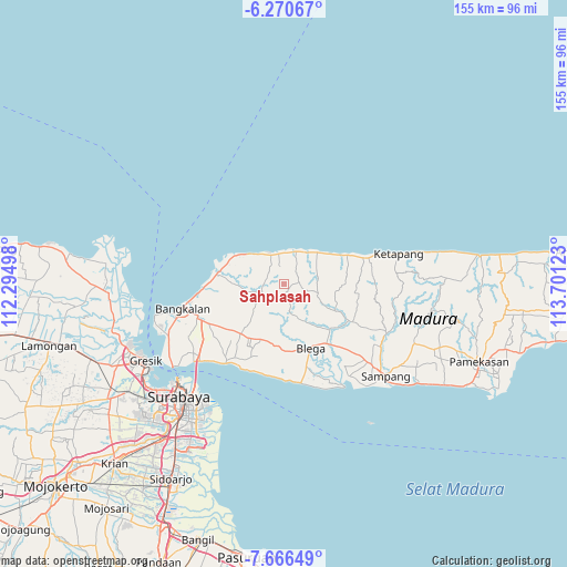
Sahplasah GPS coordinates[2]
6° 58' 8.76" South, 112° 59' 53.16" East
| Map corner | latitude | longitude |
|---|---|---|
| Upper-left | -6.27067°, | 112.29498° |
| Center: | -6.9691°, | 112.9981° |
| Lower-right: | -7.66649°, | 113.70123° |
| Map W x H: | 155.2×155.2 km | = 96.4×96.4mi |
| max Lat: | 5.88969° ⇑31.5% North |
| Sahplasah: | -6.9691° |
| min Lat: | ⇓68.5% South -10.934° |
| min Long | Sahplasah | max Long |
| 95.1345° | 112.9981° | 140.9419° |
| W 58.9%⇐ | ⇒41.1% E |
Elevation
Elevation of Sahplasah is 191 m = 627 ft, and this is 38.7 m = 127 ft below average elevation for this country.
| Max E: |
3185 m = 10449 ft | 37.4% |
| Avg. | 229.7 m = 754 ft | |
| Sahplasah | 191 m = 627 ft | |
Min E: |
-1 m = -3 ft | 62.6% |
See also: Indonesia elevation on elevation.city.
Geographical zone
Sahplasah is located in South Torrid zone (between Equator and Tropic of Capricorn). Distance of Equator is 774.9 km =481.5 mi to North.| Distance of | km | miles | from Sahplasah |
|---|---|---|---|
| Equator | 774.9 | 481.5 | to North |
| Tropic Capricorn | 1831 | 1137.7 | to South |
| Antarctic Circle | 6626.3 | 4117.4 | to South |
| South Pole | 9232.2 | 5736.6 | to South |


Nearby cities:
15 places around Sahplasah: (largest is in red/bold)
• Baratleke
2.1 km =1.3 mi,  353°
353°
• Batambak
3.7 km =2.3 mi,  210°
210°
• Cangkreng
4.3 km =2.7 mi,  272°
272°
• Gangseyan
6.5 km =4 mi,  297°
297°
• Kerbuyan
3.4 km =2.1 mi,  84°
84°
• Kokop
4.6 km =2.9 mi,  50°
50°
• Korogan Timur
5.3 km =3.3 mi,  39°
39°
• Koronganayam
6.4 km =4 mi,  260°
260°
• Labang
5.1 km =3.2 mi, 299°
• Longka
4.5 km =2.8 mi,  305°
305°
• Mandepa Barat
2.3 km =1.4 mi,  164°
164°
• Masjid
6.5 km =4 mi,  32°
32°
• Pakes
1.5 km =0.9 mi,  286°
286°
• Pakpak
6.9 km =4.3 mi,  24°
24°
• Rukgaruk
1.7 km =1.1 mi, 15°
Sources, notices
• [Note1] Compared only with cities in Indonesia existing in our database
• [Src1] Map data: © OpenStreetMap contributors (CC-BY-SA)
• [Src2] Other city data from geonames.org with taken over terms of usage.
• [Src3] Geographical zone / Annual Mean Temperature by Robert A. Rohde @ Wikipedia
