Bateke geodata
Bateke (East Java) is a seat of a fourth-order administrative division; located in Indonesia in Asia/Jakarta (GMT+7) time zone. In our database, there are 407 cities with bigger population. Compared to other cities in Indonesia, 68.9% of cities are located further ↓South; 59.8% of cities are located further ←West and 56.5% of cities have higher elevation than Bateke. Note1


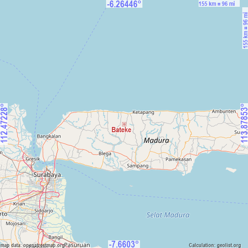
Bateke GPS coordinates[2]
6° 57' 46.44" South, 113° 10' 31.44" East
| Map corner | latitude | longitude |
|---|---|---|
| Upper-left | -6.26446°, | 112.47228° |
| Center: | -6.9629°, | 113.1754° |
| Lower-right: | -7.6603°, | 113.87853° |
| Map W x H: | 155.2×155.2 km | = 96.4×96.4mi |
| max Lat: | 5.88969° ⇑31.1% North |
| Bateke: | -6.9629° |
| min Lat: | ⇓68.9% South -10.934° |
| min Long | Bateke | max Long |
| 95.1345° | 113.1754° | 140.9419° |
| W 59.8%⇐ | ⇒40.2% E |
Elevation
Elevation of Bateke is 76 m = 249 ft, and this is 153.7 m = 504 ft below average elevation for this country.
| Max E: |
3185 m = 10449 ft | 56.5% |
| Avg. | 229.7 m = 754 ft | |
| Bateke | 76 m = 249 ft | |
Min E: |
-1 m = -3 ft | 43.5% |
See also: Indonesia elevation on elevation.city.
Geographical zone
Bateke is located in South Torrid zone (between Equator and Tropic of Capricorn). Distance of Equator is 774.2 km =481.1 mi to North.| Distance of | km | miles | from Bateke |
|---|---|---|---|
| Equator | 774.2 | 481.1 | to North |
| Tropic Capricorn | 1831.7 | 1138.2 | to South |
| Antarctic Circle | 6627 | 4117.8 | to South |
| South Pole | 9232.9 | 5737.1 | to South |


Nearby cities:
15 places around Bateke: (largest is in red/bold)
• Baih
4.5 km =2.8 mi,  259°
259°
• Galis
5.1 km =3.2 mi,  95°
95°
• Kapasan
7.1 km =4.4 mi,  9°
9°
• Korbukor
4.8 km =3 mi,  23°
23°
• Minian
6.6 km =4.1 mi,  322°
322°
• Morbatoh
5.2 km =3.2 mi,  348°
348°
• Pandian
6.2 km =3.9 mi,  326°
326°
• Ramaram
7.2 km =4.5 mi,  355°
355°
• Sebegen
2.1 km =1.3 mi,  38°
38°
• Tapaan Timur
1.7 km =1.1 mi,  312°
312°
• Taposan
0.6 km =0.4 mi, 345°
• Tebanah
5.6 km =3.5 mi,  34°
34°
• Tenggina Daya
2.4 km =1.5 mi,  81°
81°
• Tiara
5.2 km =3.2 mi,  298°
298°
• Tlagah Timur
6.7 km =4.2 mi, 37°
Sources, notices
• [Note1] Compared only with cities in Indonesia existing in our database
• [Src1] Map data: © OpenStreetMap contributors (CC-BY-SA)
• [Src2] Other city data from geonames.org with taken over terms of usage.
• [Src3] Geographical zone / Annual Mean Temperature by Robert A. Rohde @ Wikipedia
