Bukbatang geodata
Bukbatang (East Java) is a seat of a fourth-order administrative division; located in Indonesia in Asia/Jakarta (GMT+7) time zone. In our database, there are 407 cities with bigger population. Compared to other cities in Indonesia, 73% of cities are located further ↓South; 61.9% of cities are located further ←West and 89% of cities have higher elevation than Bukbatang. Note1


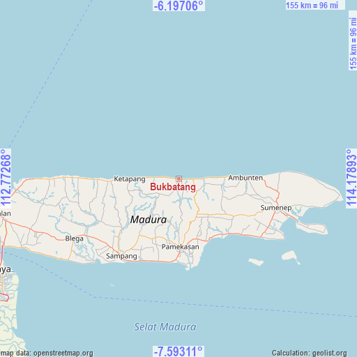
Bukbatang GPS coordinates[2]
6° 53' 44.16" South, 113° 28' 32.88" East
| Map corner | latitude | longitude |
|---|---|---|
| Upper-left | -6.19706°, | 112.77268° |
| Center: | -6.8956°, | 113.4758° |
| Lower-right: | -7.59311°, | 114.17893° |
| Map W x H: | 155.2×155.2 km | = 96.4×96.4mi |
| max Lat: | 5.88969° ⇑27% North |
| Bukbatang: | -6.8956° |
| min Lat: | ⇓73% South -10.934° |
| min Long | Bukbatang | max Long |
| 95.1345° | 113.4758° | 140.9419° |
| W 61.9%⇐ | ⇒38.1% E |
Elevation
Elevation of Bukbatang is 11 m = 36 ft, and this is 218.7 m = 718 ft below average elevation for this country.
| Max E: |
3185 m = 10449 ft | 89% |
| Avg. | 229.7 m = 754 ft | |
| Bukbatang | 11 m = 36 ft | |
Min E: |
-1 m = -3 ft | 11% |
See also: Indonesia elevation on elevation.city.
Geographical zone
Bukbatang is located in South Torrid zone (between Equator and Tropic of Capricorn). Distance of Equator is 766.7 km =476.4 mi to North.| Distance of | km | miles | from Bukbatang |
|---|---|---|---|
| Equator | 766.7 | 476.4 | to North |
| Tropic Capricorn | 1839.2 | 1142.8 | to South |
| Antarctic Circle | 6634.5 | 4122.5 | to South |
| South Pole | 9240.3 | 5741.7 | to South |


Nearby cities:
15 places around Bukbatang: (largest is in red/bold)
• Baban
3.8 km =2.4 mi,  153°
153°
• Brumbung Laok
5.7 km =3.5 mi,  127°
127°
• Kalebun
5.4 km =3.4 mi,  170°
170°
• Kranjih
5.2 km =3.2 mi,  212°
212°
• Lonpao Dajah
1.5 km =0.9 mi,  104°
104°
• Nongkesan
4 km =2.5 mi, 206°
• Pandeyan
0.5 km =0.3 mi,  139°
139°
• Pangtangis Dajah
6.2 km =3.9 mi,  243°
243°
• Rapas
6.1 km =3.8 mi, 138°
• Rokem Barat
6.2 km =3.9 mi,  91°
91°
• Sangoleng
4.3 km =2.7 mi, 96°
• Sokobanah
4.6 km =2.9 mi,  277°
277°
• Tamberu
1 km =0.6 mi,  106°
106°
• Tengah
7.2 km =4.5 mi, 112°
• Timur Dajah
5.1 km =3.2 mi, 91°
Sources, notices
• [Note1] Compared only with cities in Indonesia existing in our database
• [Src1] Map data: © OpenStreetMap contributors (CC-BY-SA)
• [Src2] Other city data from geonames.org with taken over terms of usage.
• [Src3] Geographical zone / Annual Mean Temperature by Robert A. Rohde @ Wikipedia
