Kalebun geodata
Kalebun (East Java) is a seat of a fourth-order administrative division; located in Indonesia in Asia/Jakarta (GMT+7) time zone. In our database, there are 407 cities with bigger population. Compared to other cities in Indonesia, 69.9% of cities are located further ↓South; 62% of cities are located further ←West and 63.9% of cities have lower elevation than Kalebun. Note1


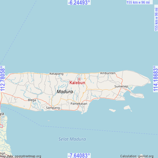
Kalebun GPS coordinates[2]
6° 56' 36.24" South, 113° 29' 1.32" East
| Map corner | latitude | longitude |
|---|---|---|
| Upper-left | -6.24493°, | 112.78058° |
| Center: | -6.9434°, | 113.4837° |
| Lower-right: | -7.64083°, | 114.18683° |
| Map W x H: | 155.2×155.2 km | = 96.4×96.4mi |
| max Lat: | 5.88969° ⇑30.1% North |
| Kalebun: | -6.9434° |
| min Lat: | ⇓69.9% South -10.934° |
| min Long | Kalebun | max Long |
| 95.1345° | 113.4837° | 140.9419° |
| W 62%⇐ | ⇒38% E |
Elevation
Elevation of Kalebun is 207 m = 679 ft, and this is 22.7 m = 74 ft below average elevation for this country.
| Max E: |
3185 m = 10449 ft | 36.1% |
| Avg. | 229.7 m = 754 ft | |
| Kalebun | 207 m = 679 ft | |
Min E: |
-1 m = -3 ft | 63.9% |
See also: Indonesia elevation on elevation.city.
Geographical zone
Kalebun is located in South Torrid zone (between Equator and Tropic of Capricorn). Distance of Equator is 772 km =479.7 mi to North.| Distance of | km | miles | from Kalebun |
|---|---|---|---|
| Equator | 772 | 479.7 | to North |
| Tropic Capricorn | 1833.9 | 1139.5 | to South |
| Antarctic Circle | 6629.1 | 4119.1 | to South |
| South Pole | 9235 | 5738.4 | to South |


Nearby cities:
15 places around Kalebun: (largest is in red/bold)
• Baban
2 km =1.2 mi,  23°
23°
• Bandungan Timur
2.3 km =1.4 mi,  166°
166°
• Brumbung Laok
4 km =2.5 mi,  63°
63°
• Bukbatang
5.4 km =3.4 mi,  350°
350°
• Danpateh
6.1 km =3.8 mi,  75°
75°
• Kranjih
3.8 km =2.4 mi,  283°
283°
• Lonpao Dajah
5 km =3.1 mi,  6°
6°
• Nomih
4.4 km =2.7 mi,  177°
177°
• Nongkesan
3.1 km =1.9 mi,  302°
302°
• Pandeyan
4.9 km =3 mi, 353°
• Rapas
3.2 km =2 mi, 76°
• Sangoleng
5.9 km =3.7 mi,  35°
35°
• Secang Barat
5.7 km =3.5 mi,  233°
233°
• Tamberu
5 km =3.1 mi,  0°
0°
• Wakduwa’ Barat
4.8 km =3 mi, 84°
Sources, notices
• [Note1] Compared only with cities in Indonesia existing in our database
• [Src1] Map data: © OpenStreetMap contributors (CC-BY-SA)
• [Src2] Other city data from geonames.org with taken over terms of usage.
• [Src3] Geographical zone / Annual Mean Temperature by Robert A. Rohde @ Wikipedia
