Lonpao Dajah geodata
Lonpao Dajah (East Java) is a seat of a fourth-order administrative division; located in Indonesia in Asia/Jakarta (GMT+7) time zone. In our database, there are 407 cities with bigger population. Compared to other cities in Indonesia, 72.7% of cities are located further ↓South; 62% of cities are located further ←West and 84.2% of cities have higher elevation than Lonpao Dajah. Note1


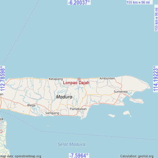
Lonpao Dajah GPS coordinates[2]
6° 53' 56.04" South, 113° 29' 20.76" East
| Map corner | latitude | longitude |
|---|---|---|
| Upper-left | -6.20037°, | 112.78598° |
| Center: | -6.8989°, | 113.4891° |
| Lower-right: | -7.5964°, | 114.19223° |
| Map W x H: | 155.2×155.2 km | = 96.4×96.4mi |
| max Lat: | 5.88969° ⇑27.3% North |
| Lonpao Dajah: | -6.8989° |
| min Lat: | ⇓72.7% South -10.934° |
| min Long | Lonpao Dajah | max Long |
| 95.1345° | 113.4891° | 140.9419° |
| W 62%⇐ | ⇒38% E |
Elevation
Elevation of Lonpao Dajah is 15 m = 49 ft, and this is 214.7 m = 704 ft below average elevation for this country.
| Max E: |
3185 m = 10449 ft | 84.2% |
| Avg. | 229.7 m = 754 ft | |
| Lonpao Dajah | 15 m = 49 ft | |
Min E: |
-1 m = -3 ft | 15.8% |
See also: Indonesia elevation on elevation.city.
Geographical zone
Lonpao Dajah is located in South Torrid zone (between Equator and Tropic of Capricorn). Distance of Equator is 767.1 km =476.7 mi to North.| Distance of | km | miles | from Lonpao Dajah |
|---|---|---|---|
| Equator | 767.1 | 476.7 | to North |
| Tropic Capricorn | 1838.8 | 1142.6 | to South |
| Antarctic Circle | 6634.1 | 4122.2 | to South |
| South Pole | 9240 | 5741.5 | to South |


Nearby cities:
15 places around Lonpao Dajah: (largest is in red/bold)
• Baban
3.1 km =1.9 mi,  175°
175°
• Brumbung Laok
4.4 km =2.7 mi,  136°
136°
• Bukbatang
1.5 km =0.9 mi,  284°
284°
• Kalebun
5 km =3.1 mi,  186°
186°
• Kranjih
5.9 km =3.7 mi,  226°
226°
• Nongkesan
4.6 km =2.9 mi,  224°
224°
• Pandeyan
1.1 km =0.7 mi,  267°
267°
• Rapas
4.9 km =3 mi,  148°
148°
• Rokem Barat
4.7 km =2.9 mi,  87°
87°
• Sangoleng
2.8 km =1.7 mi, 92°
• Sokobanah
6.1 km =3.8 mi, 279°
• Tamberu
0.5 km =0.3 mi, 279°
• Tengah
5.7 km =3.5 mi,  114°
114°
• Timur Dajah
3.6 km =2.2 mi, 86°
• Wakduwa’ Barat
6.2 km =3.9 mi, 136°
Sources, notices
• [Note1] Compared only with cities in Indonesia existing in our database
• [Src1] Map data: © OpenStreetMap contributors (CC-BY-SA)
• [Src2] Other city data from geonames.org with taken over terms of usage.
• [Src3] Geographical zone / Annual Mean Temperature by Robert A. Rohde @ Wikipedia
