Langgulang geodata
Langgulang (East Java) is a seat of a fourth-order administrative division; located in Indonesia in Asia/Jakarta (GMT+7) time zone. In our database, there are 407 cities with bigger population. Compared to other cities in Indonesia, 70.9% of cities are located further ↓South; 64.4% of cities are located further ←West and 59.2% of cities have lower elevation than Langgulang. Note1


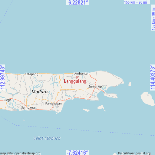
Langgulang GPS coordinates[2]
6° 55' 36.12" South, 113° 42' 2.16" East
| Map corner | latitude | longitude |
|---|---|---|
| Upper-left | -6.22821°, | 112.99748° |
| Center: | -6.9267°, | 113.7006° |
| Lower-right: | -7.62416°, | 114.40373° |
| Map W x H: | 155.2×155.2 km | = 96.4×96.4mi |
| max Lat: | 5.88969° ⇑29.1% North |
| Langgulang: | -6.9267° |
| min Lat: | ⇓70.9% South -10.934° |
| min Long | Langgulang | max Long |
| 95.1345° | 113.7006° | 140.9419° |
| W 64.4%⇐ | ⇒35.6% E |
Elevation
Elevation of Langgulang is 156 m = 512 ft, and this is 73.7 m = 242 ft below average elevation for this country.
| Max E: |
3185 m = 10449 ft | 40.8% |
| Avg. | 229.7 m = 754 ft | |
| Langgulang | 156 m = 512 ft | |
Min E: |
-1 m = -3 ft | 59.2% |
See also: Indonesia elevation on elevation.city.
Geographical zone
Langgulang is located in South Torrid zone (between Equator and Tropic of Capricorn). Distance of Equator is 770.2 km =478.6 mi to North.| Distance of | km | miles | from Langgulang |
|---|---|---|---|
| Equator | 770.2 | 478.6 | to North |
| Tropic Capricorn | 1835.7 | 1140.7 | to South |
| Antarctic Circle | 6631 | 4120.3 | to South |
| South Pole | 9236.9 | 5739.5 | to South |


Nearby cities:
15 places around Langgulang: (largest is in red/bold)
• Ambuten
6 km =3.7 mi,  45°
45°
• Bukabu
6.3 km =3.9 mi,  63°
63°
• Candi
5.3 km =3.3 mi,  73°
73°
• Den Timur
4.8 km =3 mi,  212°
212°
• Durbugan
2.6 km =1.6 mi,  12°
12°
• Duwakbuter
2.6 km =1.6 mi,  317°
317°
• Gunungtunggal
3.3 km =2.1 mi,  75°
75°
• Kokembang
6.4 km =4 mi,  243°
243°
• Lenteng
5.2 km =3.2 mi,  125°
125°
• Naekan
4.5 km =2.8 mi,  89°
89°
• Naikan
5.8 km =3.6 mi, 79°
• Pakis
2.5 km =1.6 mi,  186°
186°
• Pandan
5.2 km =3.2 mi,  35°
35°
• Pedatar Timur
4.6 km =2.9 mi,  111°
111°
• Salegading
6 km =3.7 mi,  103°
103°
Sources, notices
• [Note1] Compared only with cities in Indonesia existing in our database
• [Src1] Map data: © OpenStreetMap contributors (CC-BY-SA)
• [Src2] Other city data from geonames.org with taken over terms of usage.
• [Src3] Geographical zone / Annual Mean Temperature by Robert A. Rohde @ Wikipedia
