Timursabah geodata
Timursabah (East Java) is a seat of a fourth-order administrative division; located in Indonesia in Asia/Jakarta (GMT+7) time zone. In our database, there are 407 cities with bigger population. Compared to other cities in Indonesia, 69.5% of cities are located further ↓South; 65% of cities are located further ←West and 52.5% of cities have lower elevation than Timursabah. Note1


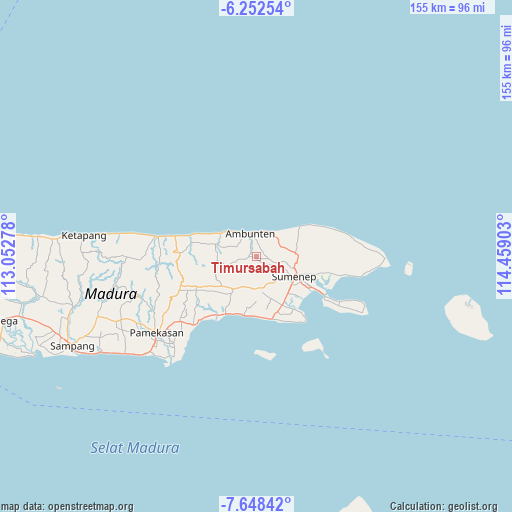
Timursabah GPS coordinates[2]
6° 57' 3.6" South, 113° 45' 21.24" East
| Map corner | latitude | longitude |
|---|---|---|
| Upper-left | -6.25254°, | 113.05278° |
| Center: | -6.951°, | 113.7559° |
| Lower-right: | -7.64842°, | 114.45903° |
| Map W x H: | 155.2×155.2 km | = 96.4×96.4mi |
| max Lat: | 5.88969° ⇑30.5% North |
| Timursabah: | -6.951° |
| min Lat: | ⇓69.5% South -10.934° |
| min Long | Timursabah | max Long |
| 95.1345° | 113.7559° | 140.9419° |
| W 65%⇐ | ⇒35% E |
Elevation
Elevation of Timursabah is 112 m = 367 ft, and this is 117.7 m = 386 ft below average elevation for this country.
| Max E: |
3185 m = 10449 ft | 47.5% |
| Avg. | 229.7 m = 754 ft | |
| Timursabah | 112 m = 367 ft | |
Min E: |
-1 m = -3 ft | 52.5% |
See also: Indonesia elevation on elevation.city.
Geographical zone
Timursabah is located in South Torrid zone (between Equator and Tropic of Capricorn). Distance of Equator is 772.9 km =480.3 mi to North.| Distance of | km | miles | from Timursabah |
|---|---|---|---|
| Equator | 772.9 | 480.3 | to North |
| Tropic Capricorn | 1833 | 1139 | to South |
| Antarctic Circle | 6628.3 | 4118.6 | to South |
| South Pole | 9234.2 | 5737.9 | to South |


Nearby cities:
15 places around Timursabah: (largest is in red/bold)
• Bun Barat
2.7 km =1.7 mi,  98°
98°
• Burneh
4.1 km =2.5 mi,  143°
143°
• Candi
4.4 km =2.7 mi,  346°
346°
• Dajalorong
2.1 km =1.3 mi,  42°
42°
• Gunong
3.7 km =2.3 mi,  49°
49°
• Gunungtunggal
4.6 km =2.9 mi,  320°
320°
• Keles Timur
2.9 km =1.8 mi, 43°
• Lenteng
1.9 km =1.2 mi,  260°
260°
• Naekan
3.2 km =2 mi,  329°
329°
• Naikan
3.8 km =2.4 mi, 354°
• Palampal
1.8 km =1.1 mi,  194°
194°
• Pedatar Timur
2.1 km =1.3 mi,  298°
298°
• Rubaru
0.9 km =0.6 mi,  202°
202°
• Salegading
1.3 km =0.8 mi, 349°
• Tengah
4.7 km =2.9 mi,  57°
57°
Sources, notices
• [Note1] Compared only with cities in Indonesia existing in our database
• [Src1] Map data: © OpenStreetMap contributors (CC-BY-SA)
• [Src2] Other city data from geonames.org with taken over terms of usage.
• [Src3] Geographical zone / Annual Mean Temperature by Robert A. Rohde @ Wikipedia
