Nenas geodata
Nenas (East Nusa Tenggara) is a seat of a fourth-order administrative division; located in Indonesia in Asia/Makassar (GMT+8) time zone. In our database, there are 407 cities with bigger population. Compared to other cities in Indonesia, 93.7% of cities are located further ↑North; 94.8% of cities are located further ←West and 98.9% of cities have lower elevation than Nenas. Note1


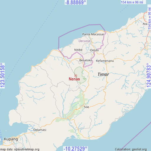
Nenas GPS coordinates[2]
9° 34' 57.72" South, 124° 12' 16.92" East
| Map corner | latitude | longitude |
|---|---|---|
| Upper-left | -8.88869°, | 123.50158° |
| Center: | -9.5827°, | 124.2047° |
| Lower-right: | -10.27529°, | 124.90783° |
| Map W x H: | 154.2×154.2 km | = 95.8×95.8mi |
| max Lat: | 5.88969° ⇑93.7% North |
| Nenas: | -9.5827° |
| min Lat: | ⇓6.3% South -10.934° |
| min Long | Nenas | max Long |
| 95.1345° | 124.2047° | 140.9419° |
| W 94.8%⇐ | ⇒5.2% E |
Elevation
Elevation of Nenas is 1192 m = 3911 ft, and this is 962.3 m = 3157 ft above average elevation for this country.
| Max E: |
3185 m = 10449 ft | 1.1% |
| Nenas | 1192 m 3911 ft | |
| Avg. | 229.7 m = 754 ft | |
Min E: |
-1 m = -3 ft | 98.9% |
See also: Indonesia elevation on elevation.city.
Geographical zone
Nenas is located in South Torrid zone (between Equator and Tropic of Capricorn). Distance of Equator is 1065.5 km =662.1 mi to North.| Distance of | km | miles | from Nenas |
|---|---|---|---|
| Equator | 1065.5 | 662.1 | to North |
| Tropic Capricorn | 1540.4 | 957.2 | to South |
| Antarctic Circle | 6335.7 | 3936.8 | to South |
| South Pole | 8941.6 | 5556.1 | to South |


Nearby cities:
15 places around Nenas: (largest is in red/bold)
• Besnakeh
13.4 km =8.3 mi,  145°
145°
• Bestamuti
12.2 km =7.6 mi,  119°
119°
• Binab
9.3 km =5.8 mi,  90°
90°
• Eban
13.5 km =8.4 mi,  76°
76°
• Fatufaun
12.8 km =8 mi,  74°
74°
• Fatumnasi
7.8 km =4.8 mi,  166°
166°
• Leloboko
11.5 km =7.1 mi,  189°
189°
• Nifu
11.5 km =7.1 mi,  211°
211°
• Nunsena
7.2 km =4.5 mi,  327°
327°
• Oehala
12 km =7.5 mi,  156°
156°
• Oenaek
10.5 km =6.5 mi, 70°
• Oesena
9.9 km =6.2 mi, 72°
• Saenam
11.8 km =7.3 mi, 66°
• Tobu
12.4 km =7.7 mi,  132°
132°
• Tutem
10.5 km =6.5 mi,  140°
140°
Sources, notices
• [Note1] Compared only with cities in Indonesia existing in our database
• [Src1] Map data: © OpenStreetMap contributors (CC-BY-SA)
• [Src2] Other city data from geonames.org with taken over terms of usage.
• [Src3] Geographical zone / Annual Mean Temperature by Robert A. Rohde @ Wikipedia
