Batuputih Atas geodata
Batuputih Atas (East Java) is a seat of a fourth-order administrative division; located in Indonesia in Asia/Jakarta (GMT+7) time zone. In our database, there are 407 cities with bigger population. Compared to other cities in Indonesia, 74.2% of cities are located further ↓South; 74.1% of cities are located further ←West and 57.9% of cities have higher elevation than Batuputih Atas. Note1


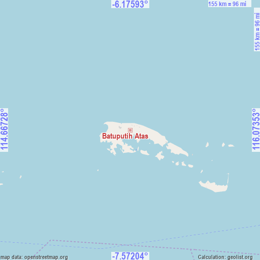
Batuputih Atas GPS coordinates[2]
6° 52' 28.2" South, 115° 22' 13.44" East
| Map corner | latitude | longitude |
|---|---|---|
| Upper-left | -6.17593°, | 114.66728° |
| Center: | -6.8745°, | 115.3704° |
| Lower-right: | -7.57204°, | 116.07353° |
| Map W x H: | 155.2×155.2 km | = 96.4×96.4mi |
| max Lat: | 5.88969° ⇑25.8% North |
| Batuputih Atas: | -6.8745° |
| min Lat: | ⇓74.2% South -10.934° |
| min Long | Batuputih Atas | max Long |
| 95.1345° | 115.3704° | 140.9419° |
| W 74.1%⇐ | ⇒25.9% E |
Elevation
Elevation of Batuputih Atas is 68 m = 223 ft, and this is 161.7 m = 531 ft below average elevation for this country.
| Max E: |
3185 m = 10449 ft | 57.9% |
| Avg. | 229.7 m = 754 ft | |
| Batuputih Atas | 68 m = 223 ft | |
Min E: |
-1 m = -3 ft | 42.1% |
See also: Indonesia elevation on elevation.city.
Geographical zone
Batuputih Atas is located in South Torrid zone (between Equator and Tropic of Capricorn). Distance of Equator is 764.4 km =475 mi to North.| Distance of | km | miles | from Batuputih Atas |
|---|---|---|---|
| Equator | 764.4 | 475 | to North |
| Tropic Capricorn | 1841.5 | 1144.3 | to South |
| Antarctic Circle | 6636.8 | 4123.9 | to South |
| South Pole | 9242.7 | 5743.1 | to South |


Nearby cities:
15 places around Batuputih Atas: (largest is in red/bold)
• Anyar
8.4 km =5.2 mi,  282°
282°
• Arjasa
9.6 km =6 mi, 279°
• Bantilan
4.3 km =2.7 mi,  5°
5°
• Baratsungai
7.5 km =4.7 mi,  110°
110°
• Beting
6.9 km =4.3 mi,  287°
287°
• Duko Tengah
10.2 km =6.3 mi, 280°
• Kettep
9.6 km =6 mi, 278°
• Kolla
2.6 km =1.6 mi,  247°
247°
• Larangan
6.3 km =3.9 mi, 253°
• Nyangkleng
8.9 km =5.5 mi, 284°
• Pasar
5.9 km =3.7 mi, 286°
• Pasarbaru
6.1 km =3.8 mi, 285°
• Tembayangan Barat
5.4 km =3.4 mi,  99°
99°
• Utarapasar
9.5 km =5.9 mi, 283°
• Wakaf
5.4 km =3.4 mi,  324°
324°
Sources, notices
• [Note1] Compared only with cities in Indonesia existing in our database
• [Src1] Map data: © OpenStreetMap contributors (CC-BY-SA)
• [Src2] Other city data from geonames.org with taken over terms of usage.
• [Src3] Geographical zone / Annual Mean Temperature by Robert A. Rohde @ Wikipedia
