Kolla geodata
Kolla (East Java) is a seat of a fourth-order administrative division; located in Indonesia in Asia/Jakarta (GMT+7) time zone. In our database, there are 407 cities with bigger population. Compared to other cities in Indonesia, 73.8% of cities are located further ↓South; 73.9% of cities are located further ←West and 71.9% of cities have higher elevation than Kolla. Note1


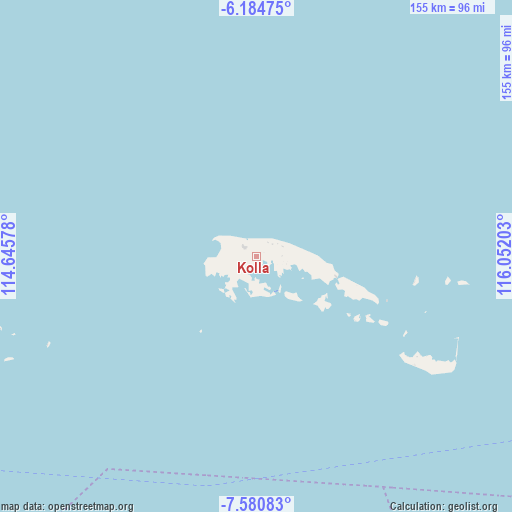
Kolla GPS coordinates[2]
6° 52' 59.88" South, 115° 20' 56.04" East
| Map corner | latitude | longitude |
|---|---|---|
| Upper-left | -6.18475°, | 114.64578° |
| Center: | -6.8833°, | 115.3489° |
| Lower-right: | -7.58083°, | 116.05203° |
| Map W x H: | 155.2×155.2 km | = 96.4×96.4mi |
| max Lat: | 5.88969° ⇑26.2% North |
| Kolla: | -6.8833° |
| min Lat: | ⇓73.8% South -10.934° |
| min Long | Kolla | max Long |
| 95.1345° | 115.3489° | 140.9419° |
| W 73.9%⇐ | ⇒26.1% E |
Elevation
Elevation of Kolla is 29 m = 95 ft, and this is 200.7 m = 658 ft below average elevation for this country.
| Max E: |
3185 m = 10449 ft | 71.9% |
| Avg. | 229.7 m = 754 ft | |
| Kolla | 29 m = 95 ft | |
Min E: |
-1 m = -3 ft | 28.1% |
See also: Indonesia elevation on elevation.city.
Geographical zone
Kolla is located in South Torrid zone (between Equator and Tropic of Capricorn). Distance of Equator is 765.4 km =475.6 mi to North.| Distance of | km | miles | from Kolla |
|---|---|---|---|
| Equator | 765.4 | 475.6 | to North |
| Tropic Capricorn | 1840.6 | 1143.7 | to South |
| Antarctic Circle | 6635.8 | 4123.3 | to South |
| South Pole | 9241.7 | 5742.5 | to South |


Nearby cities:
15 places around Kolla: (largest is in red/bold)
• Anyar
6.4 km =4 mi,  295°
295°
• Arjasa
7.5 km =4.7 mi,  290°
290°
• Bantilan
5.9 km =3.7 mi,  28°
28°
• Batuputih Atas
2.6 km =1.6 mi,  67°
67°
• Beting
5.2 km =3.2 mi,  305°
305°
• Duko Tengah
8.2 km =5.1 mi, 290°
• Kettep
7.6 km =4.7 mi, 289°
• Larangan
3.8 km =2.4 mi,  258°
258°
• Nyangkleng
7 km =4.3 mi, 296°
• Parse
9 km =5.6 mi, 286°
• Pasar
4.2 km =2.6 mi, 309°
• Pasarbaru
4.4 km =2.7 mi, 306°
• Tembayangan Barat
7.7 km =4.8 mi,  89°
89°
• Utarapasar
7.5 km =4.7 mi, 294°
• Wakaf
5.4 km =3.4 mi,  351°
351°
Sources, notices
• [Note1] Compared only with cities in Indonesia existing in our database
• [Src1] Map data: © OpenStreetMap contributors (CC-BY-SA)
• [Src2] Other city data from geonames.org with taken over terms of usage.
• [Src3] Geographical zone / Annual Mean Temperature by Robert A. Rohde @ Wikipedia
