Hadingrobi geodata
Hadingrobi (East Nusa Tenggara) is a seat of a fourth-order administrative division; located in Indonesia in Asia/Makassar (GMT+8) time zone. In our database, there are 407 cities with bigger population. Compared to other cities in Indonesia, 73.8% of cities are located further ↑North; 93.7% of cities are located further ←West and 73.1% of cities have lower elevation than Hadingrobi. Note1


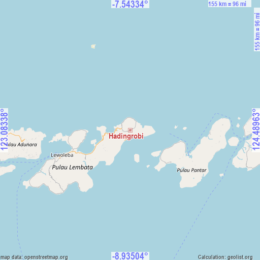
Hadingrobi GPS coordinates[2]
8° 14' 23.28" South, 123° 47' 11.4" East
| Map corner | latitude | longitude |
|---|---|---|
| Upper-left | -7.54334°, | 123.08338° |
| Center: | -8.2398°, | 123.7865° |
| Lower-right: | -8.93504°, | 124.48963° |
| Map W x H: | 154.7×154.7 km | = 96.1×96.1mi |
| max Lat: | 5.88969° ⇑73.8% North |
| Hadingrobi: | -8.2398° |
| min Lat: | ⇓26.2% South -10.934° |
| min Long | Hadingrobi | max Long |
| 95.1345° | 123.7865° | 140.9419° |
| W 93.7%⇐ | ⇒6.3% E |
Elevation
Elevation of Hadingrobi is 336 m = 1102 ft, and this is 106.3 m = 349 ft above average elevation for this country.
| Max E: |
3185 m = 10449 ft | 26.9% |
| Hadingrobi | 336 m 1102 ft | |
| Avg. | 229.7 m = 754 ft | |
Min E: |
-1 m = -3 ft | 73.1% |
See also: Indonesia elevation on elevation.city.
Geographical zone
Hadingrobi is located in South Torrid zone (between Equator and Tropic of Capricorn). Distance of Equator is 916.2 km =569.3 mi to North.| Distance of | km | miles | from Hadingrobi |
|---|---|---|---|
| Equator | 916.2 | 569.3 | to North |
| Tropic Capricorn | 1689.7 | 1049.9 | to South |
| Antarctic Circle | 6485 | 4029.6 | to South |
| South Pole | 9090.9 | 5648.8 | to South |


Nearby cities:
15 places around Hadingrobi: (largest is in red/bold)
• Aliuroba
0.4 km =0.2 mi,  63°
63°
• Hoelea
5.6 km =3.5 mi,  298°
298°
• Kaohua
5.1 km =3.2 mi,  42°
42°
• Leubatang
3.2 km =2 mi,  254°
254°
• Leuburi
4.5 km =2.8 mi, 44°
• Leudawan
3.8 km =2.4 mi,  53°
53°
• Leutubung Satu
2.8 km =1.7 mi, 62°
• Leuwayang
6.3 km =3.9 mi,  318°
318°
• Leuweheq
5.1 km =3.2 mi,  284°
284°
• Lewutung
6.3 km =3.9 mi,  27°
27°
• Meluwiting
4.4 km =2.7 mi,  267°
267°
• Orolaleng
2.4 km =1.5 mi,  255°
255°
• Peuara
4 km =2.5 mi, 262°
• Riangbao
0.8 km =0.5 mi,  234°
234°
• Roun Satu
3.4 km =2.1 mi, 57°
Sources, notices
• [Note1] Compared only with cities in Indonesia existing in our database
• [Src1] Map data: © OpenStreetMap contributors (CC-BY-SA)
• [Src2] Other city data from geonames.org with taken over terms of usage.
• [Src3] Geographical zone / Annual Mean Temperature by Robert A. Rohde @ Wikipedia
