Loang geodata
Loang (East Nusa Tenggara) is a seat of a third-order administrative division; located in Indonesia in Asia/Makassar (GMT+8) time zone. In our database, there are 407 cities with bigger population. Compared to other cities in Indonesia, 82.3% of cities are located further ↑North; 91.7% of cities are located further ←West and 72.7% of cities have higher elevation than Loang. Note1


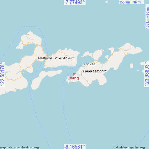
Loang GPS coordinates[2]
8° 28' 15.6" South, 123° 17' 5.64" East
| Map corner | latitude | longitude |
|---|---|---|
| Upper-left | -7.77493°, | 122.58178° |
| Center: | -8.471°, | 123.2849° |
| Lower-right: | -9.16581°, | 123.98803° |
| Map W x H: | 154.7×154.7 km | = 96.1×96.1mi |
| max Lat: | 5.88969° ⇑82.3% North |
| Loang: | -8.471° |
| min Lat: | ⇓17.7% South -10.934° |
| min Long | Loang | max Long |
| 95.1345° | 123.2849° | 140.9419° |
| W 91.7%⇐ | ⇒8.3% E |
Elevation
Elevation of Loang is 28 m = 92 ft, and this is 201.7 m = 662 ft below average elevation for this country.
| Max E: |
3185 m = 10449 ft | 72.7% |
| Avg. | 229.7 m = 754 ft | |
| Loang | 28 m = 92 ft | |
Min E: |
-1 m = -3 ft | 27.3% |
See also: Indonesia elevation on elevation.city.
Geographical zone
Loang is located in South Torrid zone (between Equator and Tropic of Capricorn). Distance of Equator is 941.9 km =585.3 mi to North.| Distance of | km | miles | from Loang |
|---|---|---|---|
| Equator | 941.9 | 585.3 | to North |
| Tropic Capricorn | 1664 | 1034 | to South |
| Antarctic Circle | 6459.3 | 4013.6 | to South |
| South Pole | 9065.2 | 5632.9 | to South |


Nearby cities:
15 places around Loang: (largest is in red/bold)
• Belang
9.5 km =5.9 mi,  61°
61°
• Boleng
9.8 km =6.1 mi,  6°
6°
• Boto
10.8 km =6.7 mi,  112°
112°
• Gayak
10.5 km =6.5 mi, 6°
• Idalolong
7.7 km =4.8 mi,  147°
147°
• Kuyalewun
11.6 km =7.2 mi,  335°
335°
• Lamalewar
8.2 km =5.1 mi,  99°
99°
• Lamawolo
10.2 km =6.3 mi, 337°
• Lewopao
10.1 km =6.3 mi,  348°
348°
• Lidang A
10.5 km =6.5 mi, 343°
• Nihaona
12 km =7.5 mi,  334°
334°
• Pasirputih
8.4 km =5.2 mi,  196°
196°
• Pukaona B
11.1 km =6.9 mi,  356°
356°
• Riangwale
10.8 km =6.7 mi, 333°
• Senadan
10 km =6.2 mi, 342°
Sources, notices
• [Note1] Compared only with cities in Indonesia existing in our database
• [Src1] Map data: © OpenStreetMap contributors (CC-BY-SA)
• [Src2] Other city data from geonames.org with taken over terms of usage.
• [Src3] Geographical zone / Annual Mean Temperature by Robert A. Rohde @ Wikipedia
