Uwa geodata
Uwa (East Nusa Tenggara) is a seat of a third-order administrative division; located in Indonesia in Asia/Makassar (GMT+8) time zone. In our database, there are 407 cities with bigger population. Compared to other cities in Indonesia, 76.5% of cities are located further ↑North; 87.2% of cities are located further ←West and 64.2% of cities have higher elevation than Uwa. Note1


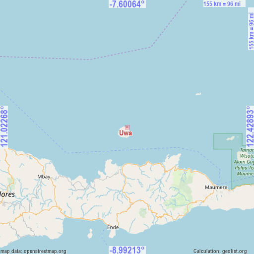
Uwa GPS coordinates[2]
8° 17' 49.2" South, 121° 43' 32.88" East
| Map corner | latitude | longitude |
|---|---|---|
| Upper-left | -7.60064°, | 121.02268° |
| Center: | -8.297°, | 121.7258° |
| Lower-right: | -8.99213°, | 122.42893° |
| Map W x H: | 154.7×154.7 km | = 96.1×96.1mi |
| max Lat: | 5.88969° ⇑76.5% North |
| Uwa: | -8.297° |
| min Lat: | ⇓23.5% South -10.934° |
| min Long | Uwa | max Long |
| 95.1345° | 121.7258° | 140.9419° |
| W 87.2%⇐ | ⇒12.8% E |
Elevation
Elevation of Uwa is 45 m = 148 ft, and this is 184.7 m = 606 ft below average elevation for this country.
| Max E: |
3185 m = 10449 ft | 64.2% |
| Avg. | 229.7 m = 754 ft | |
| Uwa | 45 m = 148 ft | |
Min E: |
-1 m = -3 ft | 35.8% |
See also: Indonesia elevation on elevation.city.
Geographical zone
Uwa is located in South Torrid zone (between Equator and Tropic of Capricorn). Distance of Equator is 922.5 km =573.2 mi to North.| Distance of | km | miles | from Uwa |
|---|---|---|---|
| Equator | 922.5 | 573.2 | to North |
| Tropic Capricorn | 1683.4 | 1046 | to South |
| Antarctic Circle | 6478.6 | 4025.6 | to South |
| South Pole | 9084.5 | 5644.8 | to South |


Nearby cities:
15 places around Uwa: (largest is in red/bold)
• Aelande
33.2 km =20.6 mi,  180°
180°
• Cawalo
3.5 km =2.2 mi,  242°
242°
• Cua
5.1 km =3.2 mi, 235°
• Detuwane
25.2 km =15.7 mi,  162°
162°
• Edo
1.4 km =0.9 mi,  171°
171°
• Jalasenga
27.4 km =17 mi, 161°
• Lei
2.7 km =1.7 mi, 238°
• Loboniki
32.7 km =20.3 mi,  137°
137°
• Londe
34.4 km =21.4 mi, 179°
• Maurole
25.2 km =15.7 mi, 160°
• Mukusaki
32.2 km =20 mi,  201°
201°
• Natu
5.1 km =3.2 mi, 160°
• Niopanda
34.4 km =21.4 mi,  145°
145°
• Welamosa
34.3 km =21.3 mi, 181°
• Wolomuku
34.2 km =21.3 mi, 177°
Sources, notices
• [Note1] Compared only with cities in Indonesia existing in our database
• [Src1] Map data: © OpenStreetMap contributors (CC-BY-SA)
• [Src2] Other city data from geonames.org with taken over terms of usage.
• [Src3] Geographical zone / Annual Mean Temperature by Robert A. Rohde @ Wikipedia
