Sobeok geodata
Sobeok (West Nusa Tenggara) is a seat of a fourth-order administrative division; located in Indonesia in Asia/Makassar (GMT+8) time zone. In our database, there are 407 cities with bigger population. Compared to other cities in Indonesia, 90.6% of cities are located further ↑North; 78.7% of cities are located further ←West and 65.4% of cities have lower elevation than Sobeok. Note1


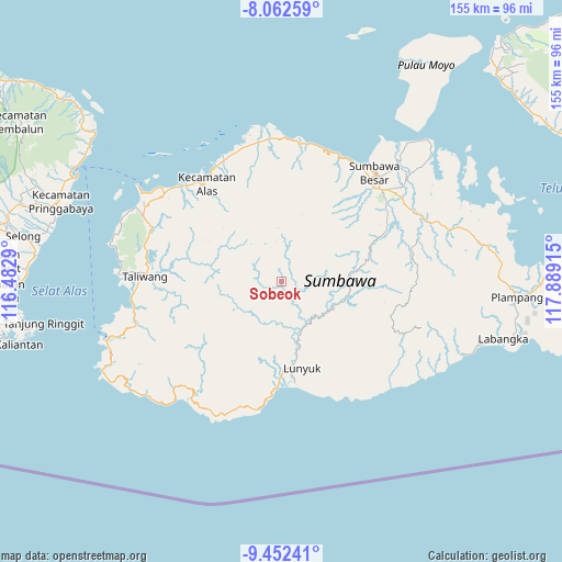
Sobeok GPS coordinates[2]
8° 45' 29.34" South, 117° 11' 9.672" East
| Map corner | latitude | longitude |
|---|---|---|
| Upper-left | -8.06259°, | 116.4829° |
| Center: | -8.75815°, | 117.18602° |
| Lower-right: | -9.45241°, | 117.88915° |
| Map W x H: | 154.5×154.5 km | = 96×96mi |
| max Lat: | 5.88969° ⇑90.6% North |
| Sobeok: | -8.75815° |
| min Lat: | ⇓9.4% South -10.934° |
| min Long | Sobeok | max Long |
| 95.1345° | 117.18602° | 140.9419° |
| W 78.7%⇐ | ⇒21.3% E |
Elevation
Elevation of Sobeok is 227 m = 745 ft, and this is 2.7 m = 9 ft below average elevation for this country.
| Max E: |
3185 m = 10449 ft | 34.6% |
| Avg. | 229.7 m = 754 ft | |
| Sobeok | 227 m = 745 ft | |
Min E: |
-1 m = -3 ft | 65.4% |
See also: Indonesia elevation on elevation.city.
Geographical zone
Sobeok is located in South Torrid zone (between Equator and Tropic of Capricorn). Distance of Equator is 973.8 km =605.1 mi to North.| Distance of | km | miles | from Sobeok |
|---|---|---|---|
| Equator | 973.8 | 605.1 | to North |
| Tropic Capricorn | 1632.1 | 1014.1 | to South |
| Antarctic Circle | 6427.4 | 3993.8 | to South |
| South Pole | 9033.2 | 5613 | to South |


Nearby cities:
15 places around Sobeok: (largest is in red/bold)
• Baodesasampar
13.8 km =8.6 mi,  343°
343°
• Batudulang
21.7 km =13.5 mi,  28°
28°
• Baturotok
11.2 km =7 mi, 336°
• Kelungkung
28.3 km =17.6 mi,  35°
35°
• Krida
24.4 km =15.2 mi,  179°
179°
• Lenangguar
19.9 km =12.4 mi,  82°
82°
• Lunyuk Ode
23.9 km =14.9 mi,  172°
172°
• Mungkin
6.5 km =4 mi,  276°
276°
• Padasuka
26.2 km =16.3 mi, 174°
• Semongkat
25.3 km =15.7 mi, 35°
• Sempe Atas
22.6 km =14 mi,  59°
59°
• Sukamaju
24 km =14.9 mi, 175°
• Tangkanpulit
11 km =6.8 mi,  352°
352°
• Tatebal
18.4 km =11.4 mi,  88°
88°
• Tepal
14.7 km =9.1 mi,  356°
356°
Sources, notices
• [Note1] Compared only with cities in Indonesia existing in our database
• [Src1] Map data: © OpenStreetMap contributors (CC-BY-SA)
• [Src2] Other city data from geonames.org with taken over terms of usage.
• [Src3] Geographical zone / Annual Mean Temperature by Robert A. Rohde @ Wikipedia
