Poja Nae geodata
Poja Nae (West Nusa Tenggara) is a seat of a fourth-order administrative division; located in Indonesia in Asia/Makassar (GMT+8) time zone. In our database, there are 407 cities with bigger population. Compared to other cities in Indonesia, 83.5% of cities are located further ↑North; 81% of cities are located further ←West and 93.7% of cities have higher elevation than Poja Nae. Note1


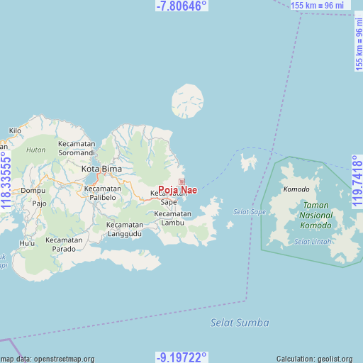
Poja Nae GPS coordinates[2]
8° 30' 8.892" South, 119° 2' 19.212" East
| Map corner | latitude | longitude |
|---|---|---|
| Upper-left | -7.80646°, | 118.33555° |
| Center: | -8.50247°, | 119.03867° |
| Lower-right: | -9.19722°, | 119.7418° |
| Map W x H: | 154.6×154.6 km | = 96.1×96.1mi |
| max Lat: | 5.88969° ⇑83.5% North |
| Poja Nae: | -8.50247° |
| min Lat: | ⇓16.5% South -10.934° |
| min Long | Poja Nae | max Long |
| 95.1345° | 119.03867° | 140.9419° |
| W 81%⇐ | ⇒19% E |
Elevation
Elevation of Poja Nae is 8 m = 26 ft, and this is 221.7 m = 727 ft below average elevation for this country.
| Max E: |
3185 m = 10449 ft | 93.7% |
| Avg. | 229.7 m = 754 ft | |
| Poja Nae | 8 m = 26 ft | |
Min E: |
-1 m = -3 ft | 6.3% |
See also: Indonesia elevation on elevation.city.
Geographical zone
Poja Nae is located in South Torrid zone (between Equator and Tropic of Capricorn). Distance of Equator is 945.4 km =587.4 mi to North.| Distance of | km | miles | from Poja Nae |
|---|---|---|---|
| Equator | 945.4 | 587.4 | to North |
| Tropic Capricorn | 1660.5 | 1031.8 | to South |
| Antarctic Circle | 6455.8 | 4011.4 | to South |
| South Pole | 9061.7 | 5630.7 | to South |


Nearby cities:
15 places around Poja Nae: (largest is in red/bold)
• Balai
12.4 km =7.7 mi,  209°
209°
• Bau
9.9 km =6.2 mi,  227°
227°
• Bombo
12.6 km =7.8 mi,  192°
192°
• Kalede
9.5 km =5.9 mi,  216°
216°
• Kowo
5.1 km =3.2 mi, 224°
• Nae
9.3 km =5.8 mi, 222°
• Naebugis
9 km =5.6 mi,  202°
202°
• Naru
9.2 km =5.7 mi, 213°
• Pai
8 km =5 mi,  349°
349°
• Pataha
4.4 km =2.7 mi, 226°
• Raioi
9.4 km =5.8 mi, 224°
• Rasabau
9.3 km =5.8 mi, 220°
• Sangia
9.1 km =5.7 mi, 221°
• Sape
9.4 km =5.8 mi, 220°
• Sukamaju
10.7 km =6.6 mi, 222°
Sources, notices
• [Note1] Compared only with cities in Indonesia existing in our database
• [Src1] Map data: © OpenStreetMap contributors (CC-BY-SA)
• [Src2] Other city data from geonames.org with taken over terms of usage.
• [Src3] Geographical zone / Annual Mean Temperature by Robert A. Rohde @ Wikipedia
