Pai geodata
Pai (West Nusa Tenggara) is a seat of a fourth-order administrative division; located in Indonesia in Asia/Makassar (GMT+8) time zone. In our database, there are 407 cities with bigger population. Compared to other cities in Indonesia, 81.2% of cities are located further ↑North; 80.9% of cities are located further ←West and 87.7% of cities have higher elevation than Pai. Note1


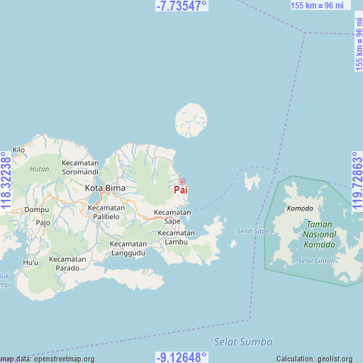
Pai GPS coordinates[2]
8° 25' 53.76" South, 119° 1' 31.8" East
| Map corner | latitude | longitude |
|---|---|---|
| Upper-left | -7.73547°, | 118.32238° |
| Center: | -8.4316°, | 119.0255° |
| Lower-right: | -9.12648°, | 119.72863° |
| Map W x H: | 154.7×154.7 km | = 96.1×96.1mi |
| max Lat: | 5.88969° ⇑81.2% North |
| Pai: | -8.4316° |
| min Lat: | ⇓18.8% South -10.934° |
| min Long | Pai | max Long |
| 95.1345° | 119.0255° | 140.9419° |
| W 80.9%⇐ | ⇒19.1% E |
Elevation
Elevation of Pai is 12 m = 39 ft, and this is 217.7 m = 714 ft below average elevation for this country.
| Max E: |
3185 m = 10449 ft | 87.7% |
| Avg. | 229.7 m = 754 ft | |
| Pai | 12 m = 39 ft | |
Min E: |
-1 m = -3 ft | 12.3% |
See also: Indonesia elevation on elevation.city.
Geographical zone
Pai is located in South Torrid zone (between Equator and Tropic of Capricorn). Distance of Equator is 937.5 km =582.5 mi to North.| Distance of | km | miles | from Pai |
|---|---|---|---|
| Equator | 937.5 | 582.5 | to North |
| Tropic Capricorn | 1668.4 | 1036.7 | to South |
| Antarctic Circle | 6463.7 | 4016.4 | to South |
| South Pole | 9069.6 | 5635.6 | to South |


Nearby cities:
15 places around Pai: (largest is in red/bold)
• Bau
15.7 km =9.8 mi,  202°
202°
• Benteng
14.3 km =8.9 mi,  302°
302°
• Kara
15.5 km =9.6 mi,  310°
310°
• Kowo
11.7 km =7.3 mi,  190°
190°
• Nae
15.6 km =9.7 mi, 198°
• Naru
16 km =9.9 mi, 192°
• Ntoke
13.3 km =8.3 mi,  281°
281°
• Oitui
12.1 km =7.5 mi,  334°
334°
• Pataha
11 km =6.8 mi, 189°
• Poja Nae
8 km =5 mi,  169°
169°
• Raioi
15.5 km =9.6 mi, 199°
• Rasabau
15.6 km =9.7 mi, 196°
• Sangia
15.3 km =9.5 mi, 197°
• Sape
15.7 km =9.8 mi, 197°
• Tawali
15.9 km =9.9 mi, 309°
Sources, notices
• [Note1] Compared only with cities in Indonesia existing in our database
• [Src1] Map data: © OpenStreetMap contributors (CC-BY-SA)
• [Src2] Other city data from geonames.org with taken over terms of usage.
• [Src3] Geographical zone / Annual Mean Temperature by Robert A. Rohde @ Wikipedia
