Tunjungan geodata
Tunjungan (Central Java) is a seat of a third-order administrative division; located in Indonesia in Asia/Jakarta (GMT+7) time zone. In our database, there are 407 cities with bigger population. Compared to other cities in Indonesia, 71.2% of cities are located further ↓South; 60.7% of cities are located further →East and 53% of cities have lower elevation than Tunjungan. Note1


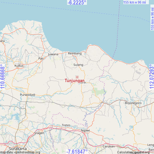
Tunjungan GPS coordinates[2]
6° 55' 15.6" South, 111° 22' 11.28" East
| Map corner | latitude | longitude |
|---|---|---|
| Upper-left | -6.2225°, | 110.66668° |
| Center: | -6.921°, | 111.3698° |
| Lower-right: | -7.61847°, | 112.07293° |
| Map W x H: | 155.2×155.2 km | = 96.4×96.4mi |
| max Lat: | 5.88969° ⇑28.8% North |
| Tunjungan: | -6.921° |
| min Lat: | ⇓71.2% South -10.934° |
| min Long | Tunjungan | max Long |
| 95.1345° | 111.3698° | 140.9419° |
| W 39.3%⇐ | ⇒60.7% E |
Elevation
Elevation of Tunjungan is 114 m = 374 ft, and this is 115.7 m = 380 ft below average elevation for this country.
| Max E: |
3185 m = 10449 ft | 47% |
| Avg. | 229.7 m = 754 ft | |
| Tunjungan | 114 m = 374 ft | |
Min E: |
-1 m = -3 ft | 53% |
See also: Indonesia elevation on elevation.city.
Geographical zone
Tunjungan is located in South Torrid zone (between Equator and Tropic of Capricorn). Distance of Equator is 769.5 km =478.1 mi to North.| Distance of | km | miles | from Tunjungan |
|---|---|---|---|
| Equator | 769.5 | 478.1 | to North |
| Tropic Capricorn | 1836.4 | 1141.1 | to South |
| Antarctic Circle | 6631.6 | 4120.7 | to South |
| South Pole | 9237.5 | 5739.9 | to South |


Nearby cities:
15 places around Tunjungan: (largest is in red/bold)
• Bogorejo
5 km =3.1 mi,  247°
247°
• Geneng
4.7 km =2.9 mi,  76°
76°
• Jembangan
3.8 km =2.4 mi,  162°
162°
• Kajangansawan
6.3 km =3.9 mi,  148°
148°
• Kalangan
2.4 km =1.5 mi,  175°
175°
• Kunden
6.5 km =4 mi,  135°
135°
• Maguwon
5.1 km =3.2 mi,  171°
171°
• Ngundaan
3.2 km =2 mi,  100°
100°
• Semanten
1.6 km =1 mi,  65°
65°
• Sembung
5.4 km =3.4 mi, 180°
• Sumberejo
6.5 km =4 mi,  276°
276°
• Triteh
4.4 km =2.7 mi,  191°
191°
• Tutup
5.9 km =3.7 mi, 157°
• Weru
6.1 km =3.8 mi,  118°
118°
• Wotbakah
6.3 km =3.9 mi, 246°
Sources, notices
• [Note1] Compared only with cities in Indonesia existing in our database
• [Src1] Map data: © OpenStreetMap contributors (CC-BY-SA)
• [Src2] Other city data from geonames.org with taken over terms of usage.
• [Src3] Geographical zone / Annual Mean Temperature by Robert A. Rohde @ Wikipedia
