Tegallega geodata
Tegallega (West Java) is a seat of a fourth-order administrative division; located in Indonesia in Asia/Jakarta (GMT+7) time zone. In our database, there are 407 cities with bigger population. Compared to other cities in Indonesia, 62.8% of cities are located further ↓South; 84.5% of cities are located further →East and 97.8% of cities have lower elevation than Tegallega. Note1


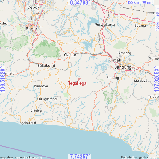
Tegallega GPS coordinates[2]
7° 2' 46.68" South, 107° 13' 20.64" East
| Map corner | latitude | longitude |
|---|---|---|
| Upper-left | -6.34798°, | 106.51928° |
| Center: | -7.0463°, | 107.2224° |
| Lower-right: | -7.74357°, | 107.92553° |
| Map W x H: | 155.2×155.2 km | = 96.4×96.4mi |
| max Lat: | 5.88969° ⇑37.2% North |
| Tegallega: | -7.0463° |
| min Lat: | ⇓62.8% South -10.934° |
| min Long | Tegallega | max Long |
| 95.1345° | 107.2224° | 140.9419° |
| W 15.5%⇐ | ⇒84.5% E |
Elevation
Elevation of Tegallega is 1019 m = 3343 ft, and this is 789.3 m = 2590 ft above average elevation for this country.
| Max E: |
3185 m = 10449 ft | 2.2% |
| Tegallega | 1019 m 3343 ft | |
| Avg. | 229.7 m = 754 ft | |
Min E: |
-1 m = -3 ft | 97.8% |
See also: Indonesia elevation on elevation.city.
Geographical zone
Tegallega is located in South Torrid zone (between Equator and Tropic of Capricorn). Distance of Equator is 783.5 km =486.8 mi to North.| Distance of | km | miles | from Tegallega |
|---|---|---|---|
| Equator | 783.5 | 486.8 | to North |
| Tropic Capricorn | 1822.4 | 1132.4 | to South |
| Antarctic Circle | 6617.7 | 4112 | to South |
| South Pole | 9223.6 | 5731.3 | to South |


Nearby cities:
15 places around Tegallega: (largest is in red/bold)
• Campaka
10 km =6.2 mi,  278°
278°
• Caringin
10.4 km =6.5 mi,  243°
243°
• Cibitung
12.9 km =8 mi,  231°
231°
• Ciherang
1.8 km =1.1 mi,  212°
212°
• Ciodeng
15.8 km =9.8 mi, 242°
• Citamiang
3.5 km =2.2 mi,  216°
216°
• Kebonkaret
7.1 km =4.4 mi,  261°
261°
• Kupel
6.3 km =3.9 mi, 238°
• Nagrog
1.5 km =0.9 mi,  31°
31°
• Parabon
15.6 km =9.7 mi, 228°
• Sukaasih
12.5 km =7.8 mi,  288°
288°
• Sukanagara
11.6 km =7.2 mi, 240°
• Walagar
4.2 km =2.6 mi, 222°
• Wangun
14.4 km =8.9 mi, 276°
• Warungsimpang
9.7 km =6 mi, 292°
Sources, notices
• [Note1] Compared only with cities in Indonesia existing in our database
• [Src1] Map data: © OpenStreetMap contributors (CC-BY-SA)
• [Src2] Other city data from geonames.org with taken over terms of usage.
• [Src3] Geographical zone / Annual Mean Temperature by Robert A. Rohde @ Wikipedia
