Tanjung geodata
Tanjung (South Kalimantan) is a seat of a second-order administrative division; located in Indonesia in Asia/Makassar (GMT+8) time zone. In our database, there are 407 cities with bigger population. Compared to other cities in Indonesia, 92.7% of cities are located further ↓South; 74.5% of cities are located further ←West and 76.2% of cities have higher elevation than Tanjung. Note1


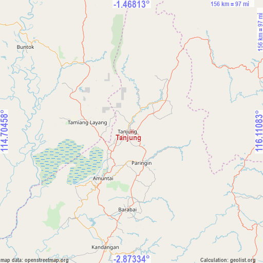
Tanjung GPS coordinates[2]
2° 10' 15.24" South, 115° 24' 27.72" East
| Map corner | latitude | longitude |
|---|---|---|
| Upper-left | -1.46813°, | 114.70458° |
| Center: | -2.1709°, | 115.4077° |
| Lower-right: | -2.87334°, | 116.11083° |
| Map W x H: | 156.2×156.2 km | = 97.1×97.1mi |
| max Lat: | 5.88969° ⇑7.3% North |
| Tanjung: | -2.1709° |
| min Lat: | ⇓92.7% South -10.934° |
| min Long | Tanjung | max Long |
| 95.1345° | 115.4077° | 140.9419° |
| W 74.5%⇐ | ⇒25.5% E |
Elevation
Elevation of Tanjung is 23 m = 75 ft, and this is 206.7 m = 678 ft below average elevation for this country.
| Max E: |
3185 m = 10449 ft | 76.2% |
| Avg. | 229.7 m = 754 ft | |
| Tanjung | 23 m = 75 ft | |
Min E: |
-1 m = -3 ft | 23.8% |
See also: Indonesia elevation on elevation.city.
Geographical zone
Tanjung is located in South Torrid zone (between Equator and Tropic of Capricorn). Distance of Equator is 241.4 km =150 mi to North.| Distance of | km | miles | from Tanjung |
|---|---|---|---|
| Equator | 241.4 | 150 | to North |
| Tropic Capricorn | 2364.5 | 1469.2 | to South |
| Antarctic Circle | 7159.8 | 4448.9 | to South |
| South Pole | 9765.7 | 6068.1 | to South |


Nearby cities:
15 places around Tanjung: (largest is in red/bold)
• Amuntai
32.6 km =20.3 mi,  212°
212°
• Batumandi
28.1 km =17.5 mi,  172°
172°
• Halong
28.7 km =17.8 mi,  109°
109°
• Haruai
20.5 km =12.7 mi,  32°
32°
• Juai
22.7 km =14.1 mi,  130°
130°
• Kelua
3.9 km =2.4 mi,  193°
193°
• Lampihung
26.9 km =16.7 mi,  150°
150°
• Mungkuruyam
21.5 km =13.4 mi,  119°
119°
• Paringin
19.8 km =12.3 mi,  157°
157°
• Pasararba
14.1 km =8.8 mi,  225°
225°
• Putatbasiun
30.9 km =19.2 mi, 154°
• Sungaiturak
20.4 km =12.7 mi, 186°
• Tamiang Layang
24.1 km =15 mi,  282°
282°
• Tanta
8.1 km =5 mi,  142°
142°
• Telagaselaba
25.8 km =16 mi,  203°
203°
Sources, notices
• [Note1] Compared only with cities in Indonesia existing in our database
• [Src1] Map data: © OpenStreetMap contributors (CC-BY-SA)
• [Src2] Other city data from geonames.org with taken over terms of usage.
• [Src3] Geographical zone / Annual Mean Temperature by Robert A. Rohde @ Wikipedia
