Lampihung geodata
Lampihung (South Kalimantan) is a seat of a third-order administrative division; located in Indonesia in Asia/Makassar (GMT+8) time zone. In our database, there are 407 cities with bigger population. Compared to other cities in Indonesia, 92.4% of cities are located further ↓South; 75.1% of cities are located further ←West and 74.9% of cities have higher elevation than Lampihung. Note1


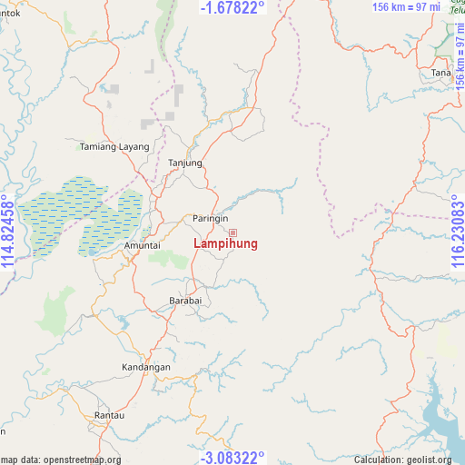
Lampihung GPS coordinates[2]
2° 22' 51.24" South, 115° 31' 39.72" East
| Map corner | latitude | longitude |
|---|---|---|
| Upper-left | -1.67822°, | 114.82458° |
| Center: | -2.3809°, | 115.5277° |
| Lower-right: | -3.08322°, | 116.23083° |
| Map W x H: | 156.2×156.2 km | = 97.1×97.1mi |
| max Lat: | 5.88969° ⇑7.6% North |
| Lampihung: | -2.3809° |
| min Lat: | ⇓92.4% South -10.934° |
| min Long | Lampihung | max Long |
| 95.1345° | 115.5277° | 140.9419° |
| W 75.1%⇐ | ⇒24.9% E |
Elevation
Elevation of Lampihung is 25 m = 82 ft, and this is 204.7 m = 672 ft below average elevation for this country.
| Max E: |
3185 m = 10449 ft | 74.9% |
| Avg. | 229.7 m = 754 ft | |
| Lampihung | 25 m = 82 ft | |
Min E: |
-1 m = -3 ft | 25.1% |
See also: Indonesia elevation on elevation.city.
Geographical zone
Lampihung is located in South Torrid zone (between Equator and Tropic of Capricorn). Distance of Equator is 264.7 km =164.5 mi to North.| Distance of | km | miles | from Lampihung |
|---|---|---|---|
| Equator | 264.7 | 164.5 | to North |
| Tropic Capricorn | 2341.2 | 1454.8 | to South |
| Antarctic Circle | 7136.4 | 4434.4 | to South |
| South Pole | 9742.3 | 6053.6 | to South |


Nearby cities:
15 places around Lampihung: (largest is in red/bold)
• Alung
18.7 km =11.6 mi,  216°
216°
• Awayan
16.7 km =10.4 mi,  122°
122°
• Batumandi
10.7 km =6.6 mi,  244°
244°
• Birayang
18.7 km =11.6 mi,  205°
205°
• Halong
19.4 km =12.1 mi,  45°
45°
• Juai
9.3 km =5.8 mi,  24°
24°
• Kelua
24.2 km =15 mi,  323°
323°
• Mungkuruyam
13.8 km =8.6 mi, 22°
• Paringin
7.7 km =4.8 mi,  310°
310°
• Pasararba
27.1 km =16.8 mi,  300°
300°
• Putatbasiun
4.4 km =2.7 mi,  177°
177°
• Sungaiturak
16 km =9.9 mi,  280°
280°
• Tanjung
26.9 km =16.7 mi,  330°
330°
• Tanta
18.9 km =11.7 mi, 333°
• Telagaselaba
23.7 km =14.7 mi,  269°
269°
Sources, notices
• [Note1] Compared only with cities in Indonesia existing in our database
• [Src1] Map data: © OpenStreetMap contributors (CC-BY-SA)
• [Src2] Other city data from geonames.org with taken over terms of usage.
• [Src3] Geographical zone / Annual Mean Temperature by Robert A. Rohde @ Wikipedia
