Sumedang Utara geodata
Sumedang Utara (West Java) is a section of populated place; located in Indonesia in Asia/Jakarta (GMT+7) time zone. With population of 100,000 people, there are 133 cities with bigger population in this country. Compared to other cities in Indonesia, 74.9% of cities are located further ↓South; 81.6% of cities are located further →East and 82.3% of cities have lower elevation than Sumedang Utara. Note1
Administrative division(s):
- Level 1: West Java
- Level 2: Kabupaten Sumedang
- Level 3: Kecamatan Sumedang Utara


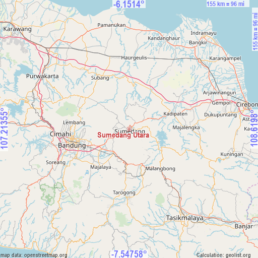
Sumedang Utara GPS coordinates[2]
6° 51' 0" South, 107° 55' 0.012" East
| Map corner | latitude | longitude |
|---|---|---|
| Upper-left | -6.1514°, | 107.21355° |
| Center: | -6.85°, | 107.91667° |
| Lower-right: | -7.54758°, | 108.6198° |
| Map W x H: | 155.2×155.2 km | = 96.4×96.4mi |
| max Lat: | 5.88969° ⇑25.1% North |
| Sumedang Utara: | -6.85° |
| min Lat: | ⇓74.9% South -10.934° |
| min Long | Sumedang Utara | max Long |
| 95.1345° | 107.91667° | 140.9419° |
| W 18.4%⇐ | ⇒81.6% E |
Elevation
Elevation of Sumedang Utara is 467 m = 1532 ft, and this is 237.3 m = 779 ft above average elevation for this country.
| Max E: |
3185 m = 10449 ft | 17.7% |
| Sumedang Utara | 467 m 1532 ft | |
| Avg. | 229.7 m = 754 ft | |
Min E: |
-1 m = -3 ft | 82.3% |
See also: Sumedang Utara elevation on elevation.city.
Geographical zone
Sumedang Utara is located in South Torrid zone (between Equator and Tropic of Capricorn). Distance of Equator is 761.6 km =473.2 mi to North.| Distance of | km | miles | from Sumedang Utara |
|---|---|---|---|
| Equator | 761.6 | 473.2 | to North |
| Tropic Capricorn | 1844.3 | 1146 | to South |
| Antarctic Circle | 6639.5 | 4125.6 | to South |
| South Pole | 9245.4 | 5744.8 | to South |


Nearby cities:
15 places around Sumedang Utara: (largest is in red/bold)
• Babakancikaso
21.1 km =13.1 mi,  152°
152°
• Ciaro
21 km =13 mi,  178°
178°
• Ciburial
21.1 km =13.1 mi, 182°
• Cigorowong Kidul
19.5 km =12.1 mi,  190°
190°
• Cihayam
20.9 km =13 mi, 147°
• Cileunyi
20.6 km =12.8 mi,  241°
241°
• Ikar
20 km =12.4 mi,  161°
161°
• Margabakti
18.7 km =11.6 mi, 193°
• Peujeuh
19.6 km =12.2 mi, 159°
• Pulosari
20.9 km =13 mi, 147°
• Putrajawa
20.2 km =12.6 mi, 148°
• Saar Kaler
19.7 km =12.2 mi, 177°
• Sindangkopo
21 km =13 mi,  144°
144°
• Sumedang
1 km =0.6 mi, 181°
• Tegallame
21 km =13 mi,  173°
173°
Sources, notices
• [Note1] Compared only with cities in Indonesia existing in our database
• [Src1] Map data: © OpenStreetMap contributors (CC-BY-SA)
• [Src2] Other city data from geonames.org with taken over terms of usage.
• [Src3] Geographical zone / Annual Mean Temperature by Robert A. Rohde @ Wikipedia
