Cileunyi geodata
Cileunyi (West Java) is a populated place; located in Indonesia in Asia/Jakarta (GMT+7) time zone. With population of 111,476 people, there are 117 cities with bigger population in this country. Compared to other cities in Indonesia, 70.2% of cities are located further ↓South; 83.3% of cities are located further →East and 91.8% of cities have lower elevation than Cileunyi. Note1


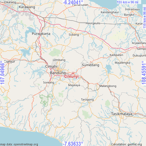
Cileunyi GPS coordinates[2]
6° 56' 20.004" South, 107° 45' 10.008" East
| Map corner | latitude | longitude |
|---|---|---|
| Upper-left | -6.24041°, | 107.04966° |
| Center: | -6.93889°, | 107.75278° |
| Lower-right: | -7.63633°, | 108.45591° |
| Map W x H: | 155.2×155.2 km | = 96.4×96.4mi |
| max Lat: | 5.88969° ⇑29.8% North |
| Cileunyi: | -6.93889° |
| min Lat: | ⇓70.2% South -10.934° |
| min Long | Cileunyi | max Long |
| 95.1345° | 107.75278° | 140.9419° |
| W 16.7%⇐ | ⇒83.3% E |
Elevation
Elevation of Cileunyi is 703 m = 2306 ft, and this is 473.3 m = 1553 ft above average elevation for this country.
| Max E: |
3185 m = 10449 ft | 8.2% |
| Cileunyi | 703 m 2306 ft | |
| Avg. | 229.7 m = 754 ft | |
Min E: |
-1 m = -3 ft | 91.8% |
See also: Cileunyi elevation on elevation.city.
Geographical zone
Cileunyi is located in South Torrid zone (between Equator and Tropic of Capricorn). Distance of Equator is 771.5 km =479.4 mi to North.| Distance of | km | miles | from Cileunyi |
|---|---|---|---|
| Equator | 771.5 | 479.4 | to North |
| Tropic Capricorn | 1834.4 | 1139.8 | to South |
| Antarctic Circle | 6629.6 | 4119.4 | to South |
| South Pole | 9235.5 | 5738.7 | to South |


Nearby cities:
15 places around Cileunyi: (largest is in red/bold)
• Bandung
16.2 km =10.1 mi,  276°
276°
• Ciaro
21.5 km =13.4 mi,  120°
120°
• Ciburial
20.4 km =12.7 mi, 123°
• Cigorowong Kidul
17.2 km =10.7 mi, 122°
• Cipeundeuy
21.7 km =13.5 mi,  135°
135°
• Karangtengah
21.6 km =13.4 mi,  134°
134°
• Lembang
20.6 km =12.8 mi,  313°
313°
• Margabakti
16 km =9.9 mi, 121°
• Margahayukencana
20.8 km =12.9 mi,  260°
260°
• Maribaya
21.3 km =13.2 mi, 140°
• Pameungpeuk
18.7 km =11.6 mi,  241°
241°
• Paseh
18.2 km =11.3 mi,  176°
176°
• Saar Kaler
21.4 km =13.3 mi, 117°
• Sumedang
20.1 km =12.5 mi,  63°
63°
• Sumedang Utara
20.6 km =12.8 mi, 61°
Sources, notices
• [Note1] Compared only with cities in Indonesia existing in our database
• [Src1] Map data: © OpenStreetMap contributors (CC-BY-SA)
• [Src2] Other city data from geonames.org with taken over terms of usage.
• [Src3] Geographical zone / Annual Mean Temperature by Robert A. Rohde @ Wikipedia
