Sekampung geodata
Sekampung (Lampung) is a seat of a third-order administrative division; located in Indonesia in Asia/Jakarta (GMT+7) time zone. In our database, there are 407 cities with bigger population. Compared to other cities in Indonesia, 88.5% of cities are located further ↓South; 94.3% of cities are located further →East and 62.1% of cities have higher elevation than Sekampung. Note1


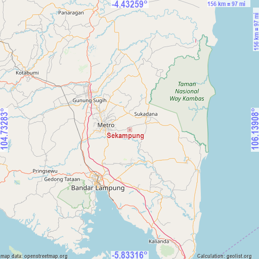
Sekampung GPS coordinates[2]
5° 7' 59.736" South, 105° 26' 9.42" East
| Map corner | latitude | longitude |
|---|---|---|
| Upper-left | -4.43259°, | 104.73283° |
| Center: | -5.13326°, | 105.43595° |
| Lower-right: | -5.83316°, | 106.13908° |
| Map W x H: | 155.7×155.7 km | = 96.7×96.7mi |
| max Lat: | 5.88969° ⇑11.5% North |
| Sekampung: | -5.13326° |
| min Lat: | ⇓88.5% South -10.934° |
| min Long | Sekampung | max Long |
| 95.1345° | 105.43595° | 140.9419° |
| W 5.7%⇐ | ⇒94.3% E |
Elevation
Elevation of Sekampung is 51 m = 167 ft, and this is 178.7 m = 586 ft below average elevation for this country.
| Max E: |
3185 m = 10449 ft | 62.1% |
| Avg. | 229.7 m = 754 ft | |
| Sekampung | 51 m = 167 ft | |
Min E: |
-1 m = -3 ft | 37.9% |
See also: Indonesia elevation on elevation.city.
Geographical zone
Sekampung is located in South Torrid zone (between Equator and Tropic of Capricorn). Distance of Equator is 570.8 km =354.7 mi to North.| Distance of | km | miles | from Sekampung |
|---|---|---|---|
| Equator | 570.8 | 354.7 | to North |
| Tropic Capricorn | 2035.2 | 1264.6 | to South |
| Antarctic Circle | 6830.4 | 4244.2 | to South |
| South Pole | 9436.3 | 5863.4 | to South |


Nearby cities:
15 places around Sekampung: (largest is in red/bold)
• Bandar Lampung
38.2 km =23.7 mi,  210°
210°
• Bandaragung
33.5 km =20.8 mi,  121°
121°
• Bangunrejo
44.2 km =27.5 mi,  268°
268°
• Batanghari
6.8 km =4.2 mi,  262°
262°
• Gunung Sugih
30.2 km =18.8 mi,  305°
305°
• Jabung
44.8 km =27.8 mi,  145°
145°
• Jepara
30 km =18.6 mi,  97°
97°
• Kedaton
34 km =21.1 mi,  215°
215°
• Metro
14.5 km =9 mi,  278°
278°
• Natar
33.3 km =20.7 mi,  234°
234°
• Panjang
40.2 km =25 mi,  198°
198°
• Pekalongan
10.2 km =6.3 mi,  303°
303°
• Punggur
20.3 km =12.6 mi, 300°
• Sukadana
14.6 km =9.1 mi,  58°
58°
• Terbanggi Besar
37.2 km =23.1 mi,  319°
319°
Sources, notices
• [Note1] Compared only with cities in Indonesia existing in our database
• [Src1] Map data: © OpenStreetMap contributors (CC-BY-SA)
• [Src2] Other city data from geonames.org with taken over terms of usage.
• [Src3] Geographical zone / Annual Mean Temperature by Robert A. Rohde @ Wikipedia
