Bandar Lampung geodata
Bandar Lampung (Lampung) is a seat of a first-order administrative division; located in Indonesia in Asia/Jakarta (GMT+7) time zone. With population of 800,348 people, there are 14 cities with bigger population in this country. Compared to other cities in Indonesia, 88.3% of cities are located further ↓South; 94.4% of cities are located further →East and 52% of cities have higher elevation than Bandar Lampung. Note1


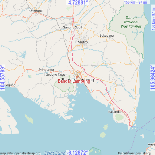
Bandar Lampung GPS coordinates[2]
5° 25' 45.012" South, 105° 15' 39.996" East
| Map corner | latitude | longitude |
|---|---|---|
| Upper-left | -4.72881°, | 104.55799° |
| Center: | -5.42917°, | 105.26111° |
| Lower-right: | -6.12872°, | 105.96424° |
| Map W x H: | 155.7×155.7 km | = 96.7×96.7mi |
| max Lat: | 5.88969° ⇑11.7% North |
| Bandar Lampung: | -5.42917° |
| min Lat: | ⇓88.3% South -10.934° |
| min Long | Bandar Lampung | max Long |
| 95.1345° | 105.26111° | 140.9419° |
| W 5.6%⇐ | ⇒94.4% E |
Elevation
Elevation of Bandar Lampung is 95 m = 312 ft, and this is 134.7 m = 442 ft below average elevation for this country.
| Max E: |
3185 m = 10449 ft | 52% |
| Avg. | 229.7 m = 754 ft | |
| Bandar Lampung | 95 m = 312 ft | |
Min E: |
-1 m = -3 ft | 48% |
See also: Bandar Lampung elevation on elevation.city.
Geographical zone
Bandar Lampung is located in South Torrid zone (between Equator and Tropic of Capricorn). Distance of Equator is 603.7 km =375.1 mi to North.| Distance of | km | miles | from Bandar Lampung |
|---|---|---|---|
| Equator | 603.7 | 375.1 | to North |
| Tropic Capricorn | 2002.3 | 1244.2 | to South |
| Antarctic Circle | 6797.5 | 4223.8 | to South |
| South Pole | 9403.4 | 5843 | to South |


Nearby cities:
15 places around Bandar Lampung: (largest is in red/bold)
• Batanghari
34.4 km =21.4 mi,  21°
21°
• Gadingrejo
23 km =14.3 mi,  285°
285°
• Gedong Tataan
19 km =11.8 mi, 285°
• Kalirejo
40.2 km =25 mi,  304°
304°
• Kedaton
5.1 km =3.2 mi,  358°
358°
• Kedondong
29 km =18 mi,  262°
262°
• Metro
35.5 km =22.1 mi,  8°
8°
• Natar
15.4 km =9.6 mi,  330°
330°
• Padangcermin
23.4 km =14.5 mi,  215°
215°
• Panjang
8.3 km =5.2 mi,  128°
128°
• Pekalongan
40 km =24.9 mi, 15°
• Pringsewu
32.7 km =20.3 mi,  283°
283°
• Sekampung
38.2 km =23.7 mi,  30°
30°
• Sidorejo
33.8 km =21 mi,  120°
120°
• Sukoharjo Satu
33.9 km =21.1 mi, 294°
Sources, notices
• [Note1] Compared only with cities in Indonesia existing in our database
• [Src1] Map data: © OpenStreetMap contributors (CC-BY-SA)
• [Src2] Other city data from geonames.org with taken over terms of usage.
• [Src3] Geographical zone / Annual Mean Temperature by Robert A. Rohde @ Wikipedia
