Nglengkir geodata
Nglengkir (Central Java) is a seat of a fourth-order administrative division; located in Indonesia in Asia/Jakarta (GMT+7) time zone. In our database, there are 407 cities with bigger population. Compared to other cities in Indonesia, 71.3% of cities are located further ↓South; 57.6% of cities are located further →East and 61.6% of cities have lower elevation than Nglengkir. Note1


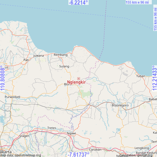
Nglengkir GPS coordinates[2]
6° 55' 11.64" South, 111° 30' 40.32" East
| Map corner | latitude | longitude |
|---|---|---|
| Upper-left | -6.2214°, | 110.80808° |
| Center: | -6.9199°, | 111.5112° |
| Lower-right: | -7.61737°, | 112.21433° |
| Map W x H: | 155.2×155.2 km | = 96.4×96.4mi |
| max Lat: | 5.88969° ⇑28.7% North |
| Nglengkir: | -6.9199° |
| min Lat: | ⇓71.3% South -10.934° |
| min Long | Nglengkir | max Long |
| 95.1345° | 111.5112° | 140.9419° |
| W 42.4%⇐ | ⇒57.6% E |
Elevation
Elevation of Nglengkir is 181 m = 594 ft, and this is 48.7 m = 160 ft below average elevation for this country.
| Max E: |
3185 m = 10449 ft | 38.4% |
| Avg. | 229.7 m = 754 ft | |
| Nglengkir | 181 m = 594 ft | |
Min E: |
-1 m = -3 ft | 61.6% |
See also: Indonesia elevation on elevation.city.
Geographical zone
Nglengkir is located in South Torrid zone (between Equator and Tropic of Capricorn). Distance of Equator is 769.4 km =478.1 mi to North.| Distance of | km | miles | from Nglengkir |
|---|---|---|---|
| Equator | 769.4 | 478.1 | to North |
| Tropic Capricorn | 1836.5 | 1141.1 | to South |
| Antarctic Circle | 6631.8 | 4120.8 | to South |
| South Pole | 9237.6 | 5740 | to South |


Nearby cities:
15 places around Nglengkir: (largest is in red/bold)
• Banyubang
3.7 km =2.3 mi,  158°
158°
• Blimbing
2.8 km =1.7 mi,  71°
71°
• Bogorejo
2.4 km =1.5 mi, 160°
• Gayamdesa
3.4 km =2.1 mi,  100°
100°
• Gembol
4.2 km =2.6 mi,  134°
134°
• Gombang
3.6 km =2.2 mi,  230°
230°
• Jeruk
2.1 km =1.3 mi,  192°
192°
• Jurangjero
2.2 km =1.4 mi,  326°
326°
• Karang
2.6 km =1.6 mi,  218°
218°
• Karanganyar
2.7 km =1.7 mi,  249°
249°
• Karangasem
3.5 km =2.2 mi,  310°
310°
• Prantaan
3.3 km =2.1 mi,  206°
206°
• Sarirejo
3.6 km =2.2 mi, 246°
• Wanutengah
2.1 km =1.3 mi, 104°
• Waru
4 km =2.5 mi, 328°
Sources, notices
• [Note1] Compared only with cities in Indonesia existing in our database
• [Src1] Map data: © OpenStreetMap contributors (CC-BY-SA)
• [Src2] Other city data from geonames.org with taken over terms of usage.
• [Src3] Geographical zone / Annual Mean Temperature by Robert A. Rohde @ Wikipedia
