Lamalera geodata
Lamalera (East Nusa Tenggara) is a seat of a fourth-order administrative division; located in Indonesia in Asia/Makassar (GMT+8) time zone. In our database, there are 407 cities with bigger population. Compared to other cities in Indonesia, 86.2% of cities are located further ↑North; 92.1% of cities are located further ←West and 70.2% of cities have higher elevation than Lamalera. Note1


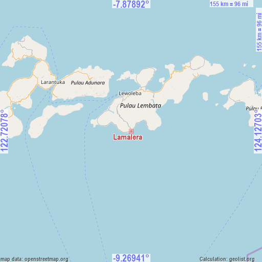
Lamalera GPS coordinates[2]
8° 34' 29.28" South, 123° 25' 26.04" East
| Map corner | latitude | longitude |
|---|---|---|
| Upper-left | -7.87892°, | 122.72078° |
| Center: | -8.5748°, | 123.4239° |
| Lower-right: | -9.26941°, | 124.12703° |
| Map W x H: | 154.6×154.6 km | = 96.1×96.1mi |
| max Lat: | 5.88969° ⇑86.2% North |
| Lamalera: | -8.5748° |
| min Lat: | ⇓13.8% South -10.934° |
| min Long | Lamalera | max Long |
| 95.1345° | 123.4239° | 140.9419° |
| W 92.1%⇐ | ⇒7.9% E |
Elevation
Elevation of Lamalera is 32 m = 105 ft, and this is 197.7 m = 649 ft below average elevation for this country.
| Max E: |
3185 m = 10449 ft | 70.2% |
| Avg. | 229.7 m = 754 ft | |
| Lamalera | 32 m = 105 ft | |
Min E: |
-1 m = -3 ft | 29.8% |
See also: Indonesia elevation on elevation.city.
Geographical zone
Lamalera is located in South Torrid zone (between Equator and Tropic of Capricorn). Distance of Equator is 953.4 km =592.4 mi to North.| Distance of | km | miles | from Lamalera |
|---|---|---|---|
| Equator | 953.4 | 592.4 | to North |
| Tropic Capricorn | 1652.5 | 1026.8 | to South |
| Antarctic Circle | 6447.7 | 4006.4 | to South |
| South Pole | 9053.6 | 5625.6 | to South |


Nearby cities:
15 places around Lamalera: (largest is in red/bold)
• Batanamang
1 km =0.6 mi,  257°
257°
• Boto
9.1 km =5.7 mi,  324°
324°
• Idalolong
12.2 km =7.6 mi,  294°
294°
• Imulolong
3.7 km =2.3 mi,  332°
332°
• Labala
10 km =6.2 mi,  47°
47°
• Lamabaka
2.3 km =1.4 mi, 258°
• Lamalewar
12.4 km =7.7 mi, 324°
• Lewopenutung
7.8 km =4.8 mi,  280°
280°
• Lewuka
8.9 km =5.5 mi,  17°
17°
• Luki
5.9 km =3.7 mi,  33°
33°
• Mulandoro
10.3 km =6.4 mi,  66°
66°
• Mulankera
9.4 km =5.8 mi, 46°
• Paobokol
10.1 km =6.3 mi,  348°
348°
• Paulolong
12.7 km =7.9 mi,  41°
41°
• Puor
4.5 km =2.8 mi,  341°
341°
Sources, notices
• [Note1] Compared only with cities in Indonesia existing in our database
• [Src1] Map data: © OpenStreetMap contributors (CC-BY-SA)
• [Src2] Other city data from geonames.org with taken over terms of usage.
• [Src3] Geographical zone / Annual Mean Temperature by Robert A. Rohde @ Wikipedia
