Labala geodata
Labala (East Nusa Tenggara) is a seat of a fourth-order administrative division; located in Indonesia in Asia/Makassar (GMT+8) time zone. In our database, there are 407 cities with bigger population. Compared to other cities in Indonesia, 84% of cities are located further ↑North; 92.3% of cities are located further ←West and 83% of cities have higher elevation than Labala. Note1


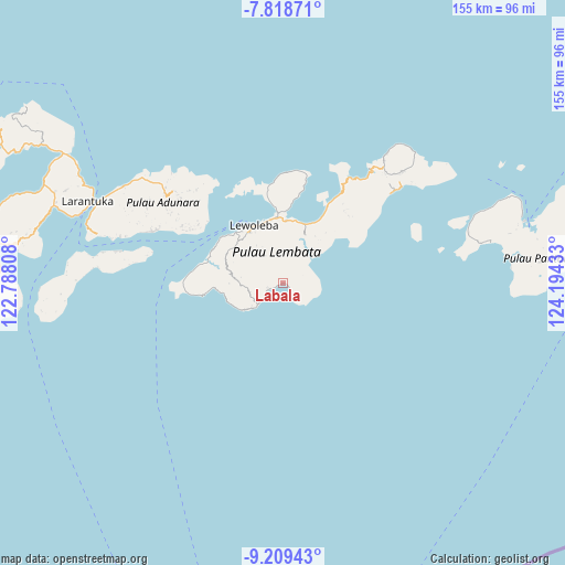
Labala GPS coordinates[2]
8° 30' 52.92" South, 123° 29' 28.32" East
| Map corner | latitude | longitude |
|---|---|---|
| Upper-left | -7.81871°, | 122.78808° |
| Center: | -8.5147°, | 123.4912° |
| Lower-right: | -9.20943°, | 124.19433° |
| Map W x H: | 154.6×154.6 km | = 96.1×96.1mi |
| max Lat: | 5.88969° ⇑84% North |
| Labala: | -8.5147° |
| min Lat: | ⇓16% South -10.934° |
| min Long | Labala | max Long |
| 95.1345° | 123.4912° | 140.9419° |
| W 92.3%⇐ | ⇒7.7% E |
Elevation
Elevation of Labala is 16 m = 52 ft, and this is 213.7 m = 701 ft below average elevation for this country.
| Max E: |
3185 m = 10449 ft | 83% |
| Avg. | 229.7 m = 754 ft | |
| Labala | 16 m = 52 ft | |
Min E: |
-1 m = -3 ft | 17% |
See also: Indonesia elevation on elevation.city.
Geographical zone
Labala is located in South Torrid zone (between Equator and Tropic of Capricorn). Distance of Equator is 946.7 km =588.3 mi to North.| Distance of | km | miles | from Labala |
|---|---|---|---|
| Equator | 946.7 | 588.3 | to North |
| Tropic Capricorn | 1659.2 | 1031 | to South |
| Antarctic Circle | 6454.4 | 4010.6 | to South |
| South Pole | 9060.3 | 5629.8 | to South |


Nearby cities:
15 places around Labala: (largest is in red/bold)
• Atawolo
3.5 km =2.2 mi,  86°
86°
• Bakan
5.9 km =3.7 mi,  337°
337°
• Karangora
7.7 km =4.8 mi,  14°
14°
• Kolirerek
8.1 km =5 mi, 344°
• Lerek
6.1 km =3.8 mi,  98°
98°
• Lewokukung
9 km =5.6 mi,  326°
326°
• Lewuka
5.1 km =3.2 mi,  291°
291°
• Luki
4.6 km =2.9 mi,  246°
246°
• Mulandoro
3.3 km =2.1 mi,  141°
141°
• Mulankera
0.7 km =0.4 mi,  255°
255°
• Paulolong
3 km =1.9 mi,  19°
19°
• Tobilolong
4.9 km =3 mi, 98°
• Waiwejak
3.9 km =2.4 mi,  62°
62°
• Watugolok
8.7 km =5.4 mi,  347°
347°
• Watuwawer
5.6 km =3.5 mi,  81°
81°
Sources, notices
• [Note1] Compared only with cities in Indonesia existing in our database
• [Src1] Map data: © OpenStreetMap contributors (CC-BY-SA)
• [Src2] Other city data from geonames.org with taken over terms of usage.
• [Src3] Geographical zone / Annual Mean Temperature by Robert A. Rohde @ Wikipedia
