Kerek geodata
Kerek (East Java) is a seat of a third-order administrative division; located in Indonesia in Asia/Jakarta (GMT+7) time zone. In our database, there are 407 cities with bigger population. Compared to other cities in Indonesia, 73.1% of cities are located further ↓South; 51.7% of cities are located further →East and 57.9% of cities have higher elevation than Kerek. Note1


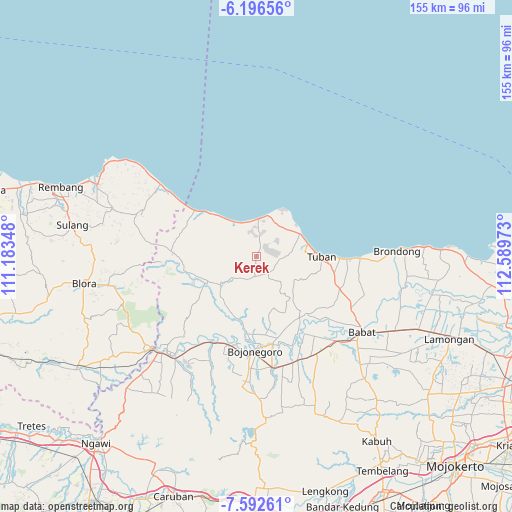
Kerek GPS coordinates[2]
6° 53' 42.36" South, 111° 53' 11.76" East
| Map corner | latitude | longitude |
|---|---|---|
| Upper-left | -6.19656°, | 111.18348° |
| Center: | -6.8951°, | 111.8866° |
| Lower-right: | -7.59261°, | 112.58973° |
| Map W x H: | 155.2×155.2 km | = 96.4×96.4mi |
| max Lat: | 5.88969° ⇑26.9% North |
| Kerek: | -6.8951° |
| min Lat: | ⇓73.1% South -10.934° |
| min Long | Kerek | max Long |
| 95.1345° | 111.8866° | 140.9419° |
| W 48.3%⇐ | ⇒51.7% E |
Elevation
Elevation of Kerek is 68 m = 223 ft, and this is 161.7 m = 531 ft below average elevation for this country.
| Max E: |
3185 m = 10449 ft | 57.9% |
| Avg. | 229.7 m = 754 ft | |
| Kerek | 68 m = 223 ft | |
Min E: |
-1 m = -3 ft | 42.1% |
See also: Indonesia elevation on elevation.city.
Geographical zone
Kerek is located in South Torrid zone (between Equator and Tropic of Capricorn). Distance of Equator is 766.7 km =476.4 mi to North.| Distance of | km | miles | from Kerek |
|---|---|---|---|
| Equator | 766.7 | 476.4 | to North |
| Tropic Capricorn | 1839.3 | 1142.9 | to South |
| Antarctic Circle | 6634.5 | 4122.5 | to South |
| South Pole | 9240.4 | 5741.7 | to South |


Nearby cities:
15 places around Kerek: (largest is in red/bold)
• Bawi Kulon
4.4 km =2.7 mi,  200°
200°
• Jarurejo
0.6 km =0.4 mi, 195°
• Karangmulyo
2.4 km =1.5 mi,  76°
76°
• Kasiman
2.3 km =1.4 mi,  358°
358°
• Margorejo
1.1 km =0.7 mi,  288°
288°
• Mekarsari
5.9 km =3.7 mi,  298°
298°
• Montongsekar
6 km =3.7 mi,  186°
186°
• Ngluwuk
2.3 km =1.4 mi,  327°
327°
• Padasan
2.1 km =1.3 mi,  117°
117°
• Pucangan
5.7 km =3.5 mi,  164°
164°
• Sidomulyo
3.4 km =2.1 mi, 304°
• Sumberarum
2.1 km =1.3 mi,  17°
17°
• Temayang
1 km =0.6 mi, 160°
• Tengger
4.9 km =3 mi,  238°
238°
• Tlogowaru
6.2 km =3.9 mi,  41°
41°
Sources, notices
• [Note1] Compared only with cities in Indonesia existing in our database
• [Src1] Map data: © OpenStreetMap contributors (CC-BY-SA)
• [Src2] Other city data from geonames.org with taken over terms of usage.
• [Src3] Geographical zone / Annual Mean Temperature by Robert A. Rohde @ Wikipedia
