Padasan geodata
Padasan (East Java) is a seat of a fourth-order administrative division; located in Indonesia in Asia/Jakarta (GMT+7) time zone. In our database, there are 407 cities with bigger population. Compared to other cities in Indonesia, 72.3% of cities are located further ↓South; 51.3% of cities are located further →East and 52.3% of cities have higher elevation than Padasan. Note1


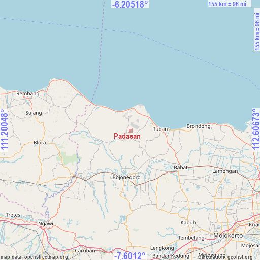
Padasan GPS coordinates[2]
6° 54' 13.32" South, 111° 54' 12.96" East
| Map corner | latitude | longitude |
|---|---|---|
| Upper-left | -6.20518°, | 111.20048° |
| Center: | -6.9037°, | 111.9036° |
| Lower-right: | -7.6012°, | 112.60673° |
| Map W x H: | 155.2×155.2 km | = 96.4×96.4mi |
| max Lat: | 5.88969° ⇑27.7% North |
| Padasan: | -6.9037° |
| min Lat: | ⇓72.3% South -10.934° |
| min Long | Padasan | max Long |
| 95.1345° | 111.9036° | 140.9419° |
| W 48.7%⇐ | ⇒51.3% E |
Elevation
Elevation of Padasan is 94 m = 308 ft, and this is 135.7 m = 445 ft below average elevation for this country.
| Max E: |
3185 m = 10449 ft | 52.3% |
| Avg. | 229.7 m = 754 ft | |
| Padasan | 94 m = 308 ft | |
Min E: |
-1 m = -3 ft | 47.7% |
See also: Indonesia elevation on elevation.city.
Geographical zone
Padasan is located in South Torrid zone (between Equator and Tropic of Capricorn). Distance of Equator is 767.6 km =477 mi to North.| Distance of | km | miles | from Padasan |
|---|---|---|---|
| Equator | 767.6 | 477 | to North |
| Tropic Capricorn | 1838.3 | 1142.3 | to South |
| Antarctic Circle | 6633.6 | 4121.9 | to South |
| South Pole | 9239.4 | 5741.1 | to South |


Nearby cities:
15 places around Padasan: (largest is in red/bold)
• Bawi Kulon
4.6 km =2.9 mi,  227°
227°
• Jarurejo
2.1 km =1.3 mi,  281°
281°
• Jetak
5.8 km =3.6 mi,  176°
176°
• Karangmulyo
1.6 km =1 mi,  16°
16°
• Kasiman
3.8 km =2.4 mi,  329°
329°
• Kerek
2.1 km =1.3 mi,  297°
297°
• Margorejo
3.2 km =2 mi,  294°
294°
• Montongsekar
5.6 km =3.5 mi,  206°
206°
• Ngluwuk
4.3 km =2.7 mi,  312°
312°
• Pucangan
4.5 km =2.8 mi, 184°
• Sidomulyo
5.5 km =3.4 mi, 301°
• Sumberarum
3.3 km =2.1 mi,  337°
337°
• Talun
5.8 km =3.6 mi,  164°
164°
• Temandangjero
5.6 km =3.5 mi,  35°
35°
• Temayang
1.5 km =0.9 mi,  269°
269°
Sources, notices
• [Note1] Compared only with cities in Indonesia existing in our database
• [Src1] Map data: © OpenStreetMap contributors (CC-BY-SA)
• [Src2] Other city data from geonames.org with taken over terms of usage.
• [Src3] Geographical zone / Annual Mean Temperature by Robert A. Rohde @ Wikipedia
