Kawunglarang geodata
Kawunglarang (West Java) is a seat of a fourth-order administrative division; located in Indonesia in Asia/Jakarta (GMT+7) time zone. In our database, there are 407 cities with bigger population. Compared to other cities in Indonesia, 56.7% of cities are located further ↓South; 71.7% of cities are located further →East and 85.1% of cities have lower elevation than Kawunglarang. Note1


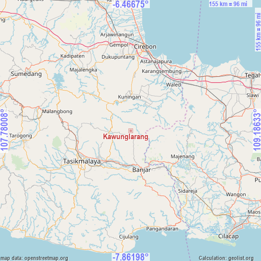
Kawunglarang GPS coordinates[2]
7° 9' 53.64" South, 108° 28' 59.52" East
| Map corner | latitude | longitude |
|---|---|---|
| Upper-left | -6.46675°, | 107.78008° |
| Center: | -7.1649°, | 108.4832° |
| Lower-right: | -7.86198°, | 109.18633° |
| Map W x H: | 155.1×155.1 km | = 96.4×96.4mi |
| max Lat: | 5.88969° ⇑43.3% North |
| Kawunglarang: | -7.1649° |
| min Lat: | ⇓56.7% South -10.934° |
| min Long | Kawunglarang | max Long |
| 95.1345° | 108.4832° | 140.9419° |
| W 28.3%⇐ | ⇒71.7% E |
Elevation
Elevation of Kawunglarang is 520 m = 1706 ft, and this is 290.3 m = 952 ft above average elevation for this country.
| Max E: |
3185 m = 10449 ft | 14.9% |
| Kawunglarang | 520 m 1706 ft | |
| Avg. | 229.7 m = 754 ft | |
Min E: |
-1 m = -3 ft | 85.1% |
See also: Indonesia elevation on elevation.city.
Geographical zone
Kawunglarang is located in South Torrid zone (between Equator and Tropic of Capricorn). Distance of Equator is 796.7 km =495 mi to North.| Distance of | km | miles | from Kawunglarang |
|---|---|---|---|
| Equator | 796.7 | 495 | to North |
| Tropic Capricorn | 1809.3 | 1124.2 | to South |
| Antarctic Circle | 6604.5 | 4103.8 | to South |
| South Pole | 9210.4 | 5723.1 | to South |


Nearby cities:
15 places around Kawunglarang: (largest is in red/bold)
• Bantardendang
2.9 km =1.8 mi,  89°
89°
• Ciberung
4.9 km =3 mi,  359°
359°
• Cileungsir
4.5 km =2.8 mi,  171°
171°
• Citapenpasir
3 km =1.9 mi,  353°
353°
• Curug
3.7 km =2.3 mi,  31°
31°
• Dadiharja
3.3 km =2.1 mi,  63°
63°
• Janglapa
3.4 km =2.1 mi,  45°
45°
• Kutamangu
5.5 km =3.4 mi, 25°
• Mekarjaya
3.7 km =2.3 mi,  279°
279°
• Pabuaran
5.1 km =3.2 mi,  266°
266°
• Rancah
4.2 km =2.6 mi,  147°
147°
• Sitularang Landeuh
5.4 km =3.4 mi,  143°
143°
• Sukaharja
1.6 km =1 mi,  333°
333°
• Tangkolo
3.1 km =1.9 mi,  78°
78°
• Tanjungjaya
3.7 km =2.3 mi,  248°
248°
Sources, notices
• [Note1] Compared only with cities in Indonesia existing in our database
• [Src1] Map data: © OpenStreetMap contributors (CC-BY-SA)
• [Src2] Other city data from geonames.org with taken over terms of usage.
• [Src3] Geographical zone / Annual Mean Temperature by Robert A. Rohde @ Wikipedia
