Serkos geodata
Serkos (West Papua) is a seat of a third-order administrative division; located in Indonesia in Asia/Jayapura (GMT+9) time zone. In our database, there are 407 cities with bigger population. Compared to other cities in Indonesia, 92.8% of cities are located further ↓South; 98.9% of cities are located further ←West and 99.8% of cities have higher elevation than Serkos. Note1


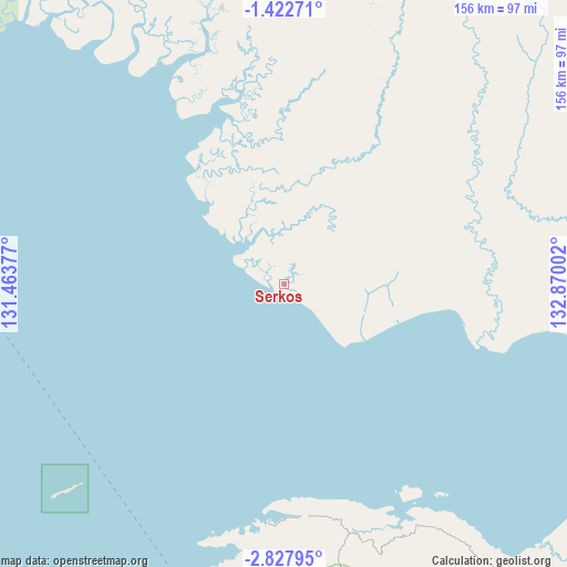
Serkos GPS coordinates[2]
2° 7' 31.764" South, 132° 10' 0.804" East
| Map corner | latitude | longitude |
|---|---|---|
| Upper-left | -1.42271°, | 131.46377° |
| Center: | -2.12549°, | 132.16689° |
| Lower-right: | -2.82795°, | 132.87002° |
| Map W x H: | 156.2×156.3 km | = 97.1×97.1mi |
| max Lat: | 5.88969° ⇑7.2% North |
| Serkos: | -2.12549° |
| min Lat: | ⇓92.8% South -10.934° |
| min Long | Serkos | max Long |
| 95.1345° | 132.16689° | 140.9419° |
| W 98.9%⇐ | ⇒1.1% E |
Elevation
Elevation of Serkos is 1 m = 3 ft, and this is 228.7 m = 750 ft below average elevation for this country.
| Max E: |
3185 m = 10449 ft | 99.8% |
| Avg. | 229.7 m = 754 ft | |
| Serkos | 1 m = 3 ft | |
Min E: |
-1 m = -3 ft | 0.2% |
See also: Indonesia elevation on elevation.city.
Geographical zone
Serkos is located in South Torrid zone (between Equator and Tropic of Capricorn). Distance of Equator is 236.3 km =146.8 mi to North.| Distance of | km | miles | from Serkos |
|---|---|---|---|
| Equator | 236.3 | 146.8 | to North |
| Tropic Capricorn | 2369.6 | 1472.4 | to South |
| Antarctic Circle | 7164.8 | 4452 | to South |
| South Pole | 9770.7 | 6071.2 | to South |


Nearby cities:
15 places around Serkos: (largest is in red/bold)
• Aifat
112.9 km =70.2 mi,  19°
19°
• Aitinyo
92.6 km =57.5 mi,  12°
12°
• Ayamaru
94.7 km =58.8 mi,  1°
1°
• Babo
146.6 km =91.1 mi,  108°
108°
• Dulanpokpok
89.8 km =55.8 mi,  172°
172°
• Fakfak
90.1 km =56 mi, 170°
• Kokas Kota
70.8 km =44 mi,  154°
154°
• Kramongmongga
74.4 km =46.2 mi,  161°
161°
• Kumurkek
103.4 km =64.2 mi, 20°
• Merdey
141 km =87.6 mi,  68°
68°
• Onimsari
123.3 km =76.6 mi,  131°
131°
• Patipi Pasir
65.4 km =40.6 mi,  183°
183°
• Raduria
92.3 km =57.4 mi, 168°
• Teminabuan
77.9 km =48.4 mi,  347°
347°
• Wanurian
118.4 km =73.6 mi,  325°
325°
Sources, notices
• [Note1] Compared only with cities in Indonesia existing in our database
• [Src1] Map data: © OpenStreetMap contributors (CC-BY-SA)
• [Src2] Other city data from geonames.org with taken over terms of usage.
• [Src3] Geographical zone / Annual Mean Temperature by Robert A. Rohde @ Wikipedia
