Fakfak geodata
Fakfak (Papua) is a seat of a second-order administrative division; located in Indonesia in Asia/Jayapura (GMT+9) time zone. In our database, there are 407 cities with bigger population. Compared to other cities in Indonesia, 91.4% of cities are located further ↓South; 98.9% of cities are located further ←West and 57.2% of cities have higher elevation than Fakfak. Note1


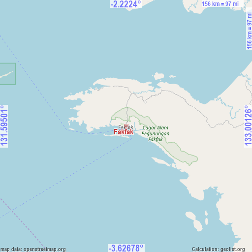
Fakfak GPS coordinates[2]
2° 55' 29.316" South, 132° 17' 53.268" East
| Map corner | latitude | longitude |
|---|---|---|
| Upper-left | -2.2224°, | 131.59501° |
| Center: | -2.92481°, | 132.29813° |
| Lower-right: | -3.62678°, | 133.00126° |
| Map W x H: | 156.2×156.2 km | = 97.1×97.1mi |
| max Lat: | 5.88969° ⇑8.6% North |
| Fakfak: | -2.92481° |
| min Lat: | ⇓91.4% South -10.934° |
| min Long | Fakfak | max Long |
| 95.1345° | 132.29813° | 140.9419° |
| W 98.9%⇐ | ⇒1.1% E |
Elevation
Elevation of Fakfak is 71 m = 233 ft, and this is 158.7 m = 521 ft below average elevation for this country.
| Max E: |
3185 m = 10449 ft | 57.2% |
| Avg. | 229.7 m = 754 ft | |
| Fakfak | 71 m = 233 ft | |
Min E: |
-1 m = -3 ft | 42.8% |
See also: Indonesia elevation on elevation.city.
Geographical zone
Fakfak is located in South Torrid zone (between Equator and Tropic of Capricorn). Distance of Equator is 325.2 km =202.1 mi to North.| Distance of | km | miles | from Fakfak |
|---|---|---|---|
| Equator | 325.2 | 202.1 | to North |
| Tropic Capricorn | 2280.7 | 1417.2 | to South |
| Antarctic Circle | 7076 | 4396.8 | to South |
| South Pole | 9681.9 | 6016.1 | to South |


Nearby cities:
15 places around Fakfak: (largest is in red/bold)
• Aitinyo
179.4 km =111.5 mi,  1°
1°
• Ayamaru
183.9 km =114.3 mi,  356°
356°
• Babo
131.8 km =81.9 mi,  70°
70°
• Bintuni
164.9 km =102.5 mi,  56°
56°
• Bofuer
162.9 km =101.2 mi,  93°
93°
• Dulanpokpok
2.9 km =1.8 mi,  266°
266°
• Kaimana
182.4 km =113.3 mi,  116°
116°
• Kokas Kota
29.3 km =18.2 mi,  32°
32°
• Kramongmongga
20.5 km =12.7 mi, 26°
• Merdey
182.5 km =113.4 mi,  39°
39°
• Onimsari
77.3 km =48 mi, 85°
• Patipi Pasir
30.3 km =18.8 mi,  321°
321°
• Raduria
4.3 km =2.7 mi,  111°
111°
• Serkos
90.1 km =56 mi,  350°
350°
• Teminabuan
167.9 km =104.3 mi, 349°
Sources, notices
• [Note1] Compared only with cities in Indonesia existing in our database
• [Src1] Map data: © OpenStreetMap contributors (CC-BY-SA)
• [Src2] Other city data from geonames.org with taken over terms of usage.
• [Src3] Geographical zone / Annual Mean Temperature by Robert A. Rohde @ Wikipedia
