Gunungkendeng geodata
Gunungkendeng (Banten) is a seat of a fourth-order administrative division; located in Indonesia in Asia/Jakarta (GMT+7) time zone. In our database, there are 407 cities with bigger population. Compared to other cities in Indonesia, 81.4% of cities are located further ↓South; 90.2% of cities are located further →East and 67.7% of cities have lower elevation than Gunungkendeng. Note1


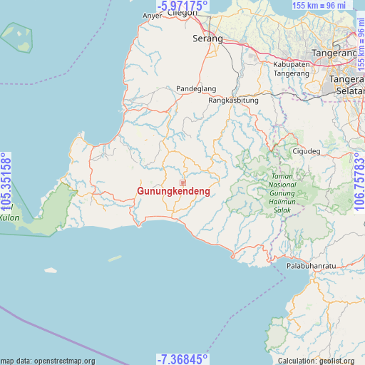
Gunungkendeng GPS coordinates[2]
6° 40' 14.16" South, 106° 3' 16.92" East
| Map corner | latitude | longitude |
|---|---|---|
| Upper-left | -5.97175°, | 105.35158° |
| Center: | -6.6706°, | 106.0547° |
| Lower-right: | -7.36845°, | 106.75783° |
| Map W x H: | 155.3×155.3 km | = 96.5×96.5mi |
| max Lat: | 5.88969° ⇑18.6% North |
| Gunungkendeng: | -6.6706° |
| min Lat: | ⇓81.4% South -10.934° |
| min Long | Gunungkendeng | max Long |
| 95.1345° | 106.0547° | 140.9419° |
| W 9.8%⇐ | ⇒90.2% E |
Elevation
Elevation of Gunungkendeng is 260 m = 853 ft, and this is 30.3 m = 99 ft above average elevation for this country.
| Max E: |
3185 m = 10449 ft | 32.3% |
| Gunungkendeng | 260 m 853 ft | |
| Avg. | 229.7 m = 754 ft | |
Min E: |
-1 m = -3 ft | 67.7% |
See also: Indonesia elevation on elevation.city.
Geographical zone
Gunungkendeng is located in South Torrid zone (between Equator and Tropic of Capricorn). Distance of Equator is 741.7 km =460.9 mi to North.| Distance of | km | miles | from Gunungkendeng |
|---|---|---|---|
| Equator | 741.7 | 460.9 | to North |
| Tropic Capricorn | 1864.2 | 1158.4 | to South |
| Antarctic Circle | 6659.5 | 4138 | to South |
| South Pole | 9265.4 | 5757.3 | to South |


Nearby cities:
15 places around Gunungkendeng: (largest is in red/bold)
• Bulakan
3.7 km =2.3 mi,  319°
319°
• Cidima
8.8 km =5.5 mi,  349°
349°
• Cipeundeuy
7.3 km =4.5 mi,  116°
116°
• Ciseda
8.3 km =5.2 mi,  298°
298°
• Citeureup
3.4 km =2.1 mi,  42°
42°
• Kadubetara
5.2 km =3.2 mi,  21°
21°
• Kampungsawah
8.7 km =5.4 mi,  266°
266°
• Kandangsapi
8.5 km =5.3 mi,  199°
199°
• Lebakmasjid
8.1 km =5 mi,  25°
25°
• Pamundayan Kaler
4.4 km =2.7 mi,  228°
228°
• Parakanlima
7.3 km =4.5 mi,  53°
53°
• Peucangpari
7.7 km =4.8 mi,  126°
126°
• Simpanggarung
4.4 km =2.7 mi,  187°
187°
• Sukakerta
0.6 km =0.4 mi, 192°
• Sukamaju
4.2 km =2.6 mi,  156°
156°
Sources, notices
• [Note1] Compared only with cities in Indonesia existing in our database
• [Src1] Map data: © OpenStreetMap contributors (CC-BY-SA)
• [Src2] Other city data from geonames.org with taken over terms of usage.
• [Src3] Geographical zone / Annual Mean Temperature by Robert A. Rohde @ Wikipedia
