Sukamaju geodata
Sukamaju (Banten) is a seat of a third-order administrative division; located in Indonesia in Asia/Jakarta (GMT+7) time zone. In our database, there are 407 cities with bigger population. Compared to other cities in Indonesia, 80.5% of cities are located further ↓South; 90.1% of cities are located further →East and 70.1% of cities have lower elevation than Sukamaju. Note1


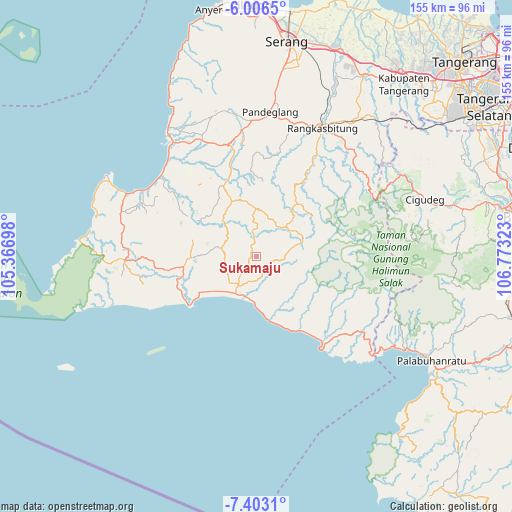
Sukamaju GPS coordinates[2]
6° 42' 19.08" South, 106° 4' 12.36" East
| Map corner | latitude | longitude |
|---|---|---|
| Upper-left | -6.0065°, | 105.36698° |
| Center: | -6.7053°, | 106.0701° |
| Lower-right: | -7.4031°, | 106.77323° |
| Map W x H: | 155.3×155.3 km | = 96.5×96.5mi |
| max Lat: | 5.88969° ⇑19.5% North |
| Sukamaju: | -6.7053° |
| min Lat: | ⇓80.5% South -10.934° |
| min Long | Sukamaju | max Long |
| 95.1345° | 106.0701° | 140.9419° |
| W 9.9%⇐ | ⇒90.1% E |
Elevation
Elevation of Sukamaju is 292 m = 958 ft, and this is 62.3 m = 204 ft above average elevation for this country.
| Max E: |
3185 m = 10449 ft | 29.9% |
| Sukamaju | 292 m 958 ft | |
| Avg. | 229.7 m = 754 ft | |
Min E: |
-1 m = -3 ft | 70.1% |
See also: Indonesia elevation on elevation.city.
Geographical zone
Sukamaju is located in South Torrid zone (between Equator and Tropic of Capricorn). Distance of Equator is 745.6 km =463.3 mi to North.| Distance of | km | miles | from Sukamaju |
|---|---|---|---|
| Equator | 745.6 | 463.3 | to North |
| Tropic Capricorn | 1860.4 | 1156 | to South |
| Antarctic Circle | 6655.6 | 4135.6 | to South |
| South Pole | 9261.5 | 5754.8 | to South |


Nearby cities:
15 places around Sukamaju: (largest is in red/bold)
• Bulakan
7.8 km =4.8 mi,  328°
328°
• Ciapus
4.9 km =3 mi,  157°
157°
• Cipeundeuy
4.8 km =3 mi,  83°
83°
• Citeureup
6.4 km =4 mi,  4°
4°
• Gunungkendeng
4.2 km =2.6 mi,  336°
336°
• Kadubetara
8.7 km =5.4 mi, 1°
• Kadujajar
6.8 km =4.2 mi,  225°
225°
• Kandangsapi
6.2 km =3.9 mi, 227°
• Manglid
7.8 km =4.8 mi,  144°
144°
• Nyungcung
7.9 km =4.9 mi,  98°
98°
• Pamundayan Kaler
5.1 km =3.2 mi,  281°
281°
• Peucangpari
4.6 km =2.9 mi, 98°
• Simpanggarung
2.3 km =1.4 mi,  257°
257°
• Sukakerta
3.7 km =2.3 mi, 330°
• Sukamaju
7.7 km =4.8 mi,  196°
196°
Sources, notices
• [Note1] Compared only with cities in Indonesia existing in our database
• [Src1] Map data: © OpenStreetMap contributors (CC-BY-SA)
• [Src2] Other city data from geonames.org with taken over terms of usage.
• [Src3] Geographical zone / Annual Mean Temperature by Robert A. Rohde @ Wikipedia
