Lehavim geodata
Lehavim (Southern District) is a populated place; located in Israel in Asia/Jerusalem (GMT+3) time zone. With population of 6,000 people, there are 102 cities with bigger population in this country. Compared to other cities in Israel, 94.7% of cities are located further ↑North; 85.2% of cities are located further →East and 73.4% of cities have lower elevation than Lehavim. Note1


Lehavim GPS coordinates[2]
31° 22' 22.224" North, 34° 48' 58.284" East
| Map corner | latitude | longitude |
|---|---|---|
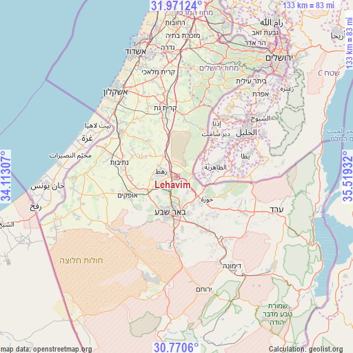
| Upper-left | 31.97124°, | 34.11307° |
| Center: | 31.37284°, | 34.81619° |
| Lower-right: | 30.7706°, | 35.51932° |
| Map W x H: | 133.5×133.5 km | = 83×83mi |
| max Lat: | 33.27918° ⇑94.7% North |
| Lehavim: | 31.37284° |
| min Lat: | ⇓5.3% South 29.55805° |
| min Long | Lehavim | max Long |
| 34.57149° | 34.81619° | 35.81084° |
| W 14.8%⇐ | ⇒85.2% E |
Elevation
Elevation of Lehavim is 317 m = 1040 ft, and this is 93.6 m = 307 ft above average elevation for this country.
| Max E: |
988 m = 3241 ft | 26.6% |
| Lehavim | 317 m 1040 ft | |
| Avg. | 223.4 m = 733 ft | |
Min E: |
-380 m = -1247 ft | 73.4% |
See also: Israel elevation on elevation.city.
Geographical zone
Lehavim is located in North temperate zone (between Tropic of Cancer and the Arctic Circle). Distance of this Northern Tropic circle is 882.4 km =548.3 mi to South.| Distance of | km | miles | from Lehavim |
|---|---|---|---|
| North Pole | 6518.7 | 4050.5 | to North |
| Arctic Circle | 3912.8 | 2431.3 | to North |
| Tropic Cancer | 882.4 | 548.3 | to South |
| Equator | 3488.3 | 2167.5 | to South |


Nearby cities:
15 places around Lehavim: (largest is in red/bold)
• Arad
39.8 km =24.7 mi,  108°
108°
• Ashkelon
40.3 km =25 mi,  324°
324°
• Beersheba
13.7 km =8.5 mi,  189°
189°
• Bet Shemesh
43.2 km =26.8 mi,  22°
22°
• Bnei Ayish
46.1 km =28.6 mi,  352°
352°
• Dimona
39.4 km =24.5 mi,  148°
148°
• Gan Yavne
47.2 km =29.3 mi, 347°
• Mevo Betar
47.6 km =29.6 mi,  35°
35°
• Netivot
22.3 km =13.9 mi,  284°
284°
• Ofaqim
19.7 km =12.2 mi,  250°
250°
• Qiryat Gat
26.8 km =16.7 mi, 349°
• Rahat
6.2 km =3.9 mi,  294°
294°
• Sederot
26.8 km =16.7 mi,  309°
309°
• Yeroẖam
44.2 km =27.5 mi,  165°
165°
• Ẕur Hadassa
46.8 km =29.1 mi,  34°
34°
Sources, notices
• [Note1] Compared only with cities in Israel existing in our database
• [Src1] Map data: © OpenStreetMap contributors (CC-BY-SA)
• [Src2] Other city data from geonames.org with taken over terms of usage.
• [Src3] Geographical zone / Annual Mean Temperature by Robert A. Rohde @ Wikipedia
