Yeroẖam geodata
Yeroẖam (Southern District) is a populated place; located in Israel in Asia/Jerusalem (GMT+2) time zone. With population of 8,631 people, there are 91 cities with bigger population in this country. Compared to other cities in Israel, 98.2% of cities are located further ↑North; 66.9% of cities are located further →East and 82.8% of cities have lower elevation than Yeroẖam. Note1


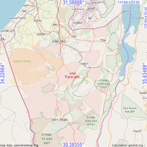
Yeroẖam GPS coordinates[2]
30° 59' 17.592" North, 34° 55' 54.336" East
| Map corner | latitude | longitude |
|---|---|---|
| Upper-left | 31.58908°, | 34.22864° |
| Center: | 30.98822°, | 34.93176° |
| Lower-right: | 30.38355°, | 35.63489° |
| Map W x H: | 134×134 km | = 83.3×83.3mi |
| max Lat: | 33.27918° ⇑98.2% North |
| Yeroẖam: | 30.98822° |
| min Lat: | ⇓1.8% South 29.55805° |
| min Long | Yeroẖam | max Long |
| 34.57149° | 34.93176° | 35.81084° |
| W 33.1%⇐ | ⇒66.9% E |
Elevation
Elevation of Yeroẖam is 499 m = 1637 ft, and this is 275.6 m = 904 ft above average elevation for this country.
| Max E: |
988 m = 3241 ft | 17.2% |
| Yeroẖam | 499 m 1637 ft | |
| Avg. | 223.4 m = 733 ft | |
Min E: |
-380 m = -1247 ft | 82.8% |
See also: Israel elevation on elevation.city.
Geographical zone
Yeroẖam is located in North temperate zone (between Tropic of Cancer and the Arctic Circle). Distance of this Northern Tropic circle is 839.6 km =521.7 mi to South.| Distance of | km | miles | from Yeroẖam |
|---|---|---|---|
| North Pole | 6561.5 | 4077.1 | to North |
| Arctic Circle | 3955.6 | 2457.9 | to North |
| Tropic Cancer | 839.6 | 521.7 | to South |
| Equator | 3445.6 | 2141 | to South |


Nearby cities:
15 places around Yeroẖam: (largest is in red/bold)
• Arad
40.3 km =25 mi,  41°
41°
• Beersheba
32.2 km =20 mi,  335°
335°
• Bet Shemesh
82.8 km =51.4 mi,  4°
4°
• Dimona
13.3 km =8.3 mi,  46°
46°
• Lehavim
44.2 km =27.5 mi,  345°
345°
• Midreshet Ben-Gurion
20.8 km =12.9 mi,  222°
222°
• Mitzpe Ramon
43.9 km =27.3 mi,  196°
196°
• Netivot
58.3 km =36.2 mi,  326°
326°
• Ofaqim
46.8 km =29.1 mi,  320°
320°
• Qiryat Gat
70.9 km =44.1 mi, 347°
• Rahat
48.2 km =30 mi, 339°
• Sederot
67.6 km =42 mi, 331°
• Ẕur Hadassa
82.8 km =51.4 mi,  10°
10°
• ‘En Boqeq
47.3 km =29.4 mi,  60°
60°
• ‘En Gedi
67.2 km =41.8 mi, 39°
Sources, notices
• [Note1] Compared only with cities in Israel existing in our database
• [Src1] Map data: © OpenStreetMap contributors (CC-BY-SA)
• [Src2] Other city data from geonames.org with taken over terms of usage.
• [Src3] Geographical zone / Annual Mean Temperature by Robert A. Rohde @ Wikipedia
