Rumat Heib geodata
Rumat Heib (Northern District) is a populated place; located in Israel in Asia/Jerusalem (GMT+3) time zone. With population of 1,588 people, there are 147 cities with bigger population in this country. Compared to other cities in Israel, 74% of cities are located further ↓South; 78.7% of cities are located further ←West and 60.4% of cities have lower elevation than Rumat Heib. Note1


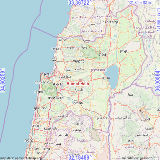
Rumat Heib GPS coordinates[2]
32° 46' 40.872" North, 35° 18' 20.556" East
| Map corner | latitude | longitude |
|---|---|---|
| Upper-left | 33.36722°, | 34.60259° |
| Center: | 32.77802°, | 35.30571° |
| Lower-right: | 32.18489°, | 36.00884° |
| Map W x H: | 131.5×131.5 km | = 81.7×81.7mi |
| max Lat: | 33.27918° ⇑26% North |
| Rumat Heib: | 32.77802° |
| min Lat: | ⇓74% South 29.55805° |
| min Long | Rumat Heib | max Long |
| 34.57149° | 35.30571° | 35.81084° |
| W 78.7%⇐ | ⇒21.3% E |
Elevation
Elevation of Rumat Heib is 221 m = 725 ft, and this is 2.4 m = 8 ft below average elevation for this country.
| Max E: |
988 m = 3241 ft | 39.6% |
| Avg. | 223.4 m = 733 ft | |
| Rumat Heib | 221 m = 725 ft | |
Min E: |
-380 m = -1247 ft | 60.4% |
See also: Israel elevation on elevation.city.
Geographical zone
Rumat Heib is located in North temperate zone (between Tropic of Cancer and the Arctic Circle). Distance of this Northern Tropic circle is 1038.7 km =645.4 mi to South.| Distance of | km | miles | from Rumat Heib |
|---|---|---|---|
| North Pole | 6362.5 | 3953.5 | to North |
| Arctic Circle | 3756.6 | 2334.2 | to North |
| Tropic Cancer | 1038.7 | 645.4 | to South |
| Equator | 3644.6 | 2264.6 | to South |


Nearby cities:
15 places around Rumat Heib: (largest is in red/bold)
• Bu‘eina
6.4 km =4 mi,  60°
60°
• Bīr el Maksūr
7.9 km =4.9 mi,  269°
269°
• Dabbūrīya
11.3 km =7 mi,  147°
147°
• Deir Ḥannā
10.8 km =6.7 mi,  30°
30°
• Er Reina
6.2 km =3.9 mi,  170°
170°
• Iksāl
10.8 km =6.7 mi, 171°
• Kafr Kannā
4.9 km =3 mi,  135°
135°
• Kafr Mandā
5.6 km =3.5 mi,  310°
310°
• Kaukab Abū el Hījā
8 km =5 mi,  318°
318°
• Nazareth
8.6 km =5.3 mi,  185°
185°
• Sakhnīn
9.6 km =6 mi,  355°
355°
• Timrat
11.3 km =7 mi,  222°
222°
• Ẕippori
4.4 km =2.7 mi,  213°
213°
• ‘Eilabun
11 km =6.8 mi,  53°
53°
• ‘Uzeir
2.7 km =1.7 mi, 55°
Sources, notices
• [Note1] Compared only with cities in Israel existing in our database
• [Src1] Map data: © OpenStreetMap contributors (CC-BY-SA)
• [Src2] Other city data from geonames.org with taken over terms of usage.
• [Src3] Geographical zone / Annual Mean Temperature by Robert A. Rohde @ Wikipedia
