‘Uzeir geodata
‘Uzeir (Northern District) is a populated place; located in Israel in Asia/Jerusalem (GMT+3) time zone. With population of 2,591 people, there are 130 cities with bigger population in this country. Compared to other cities in Israel, 75.1% of cities are located further ↓South; 81.7% of cities are located further ←West and 56.2% of cities have lower elevation than ‘Uzeir. Note1


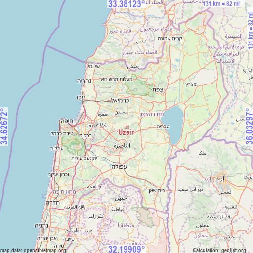
‘Uzeir GPS coordinates[2]
32° 47' 31.632" North, 35° 19' 47.424" East
| Map corner | latitude | longitude |
|---|---|---|
| Upper-left | 33.38123°, | 34.62672° |
| Center: | 32.79212°, | 35.32984° |
| Lower-right: | 32.19909°, | 36.03297° |
| Map W x H: | 131.4×131.4 km | = 81.6×81.6mi |
| max Lat: | 33.27918° ⇑24.9% North |
| ‘Uzeir: | 32.79212° |
| min Lat: | ⇓75.1% South 29.55805° |
| min Long | ‘Uzeir | max Long |
| 34.57149° | 35.32984° | 35.81084° |
| W 81.7%⇐ | ⇒18.3% E |
Elevation
Elevation of ‘Uzeir is 166 m = 545 ft, and this is 57.4 m = 188 ft below average elevation for this country.
| Max E: |
988 m = 3241 ft | 43.8% |
| Avg. | 223.4 m = 733 ft | |
| ‘Uzeir | 166 m = 545 ft | |
Min E: |
-380 m = -1247 ft | 56.2% |
See also: Israel elevation on elevation.city.
Geographical zone
‘Uzeir is located in North temperate zone (between Tropic of Cancer and the Arctic Circle). Distance of this Northern Tropic circle is 1040.2 km =646.4 mi to South.| Distance of | km | miles | from ‘Uzeir |
|---|---|---|---|
| North Pole | 6360.9 | 3952.5 | to North |
| Arctic Circle | 3755 | 2333.2 | to North |
| Tropic Cancer | 1040.2 | 646.4 | to South |
| Equator | 3646.1 | 2265.6 | to South |


Nearby cities:
15 places around ‘Uzeir: (largest is in red/bold)
• Bu‘eina
3.6 km =2.2 mi,  64°
64°
• Bīr el Maksūr
10.3 km =6.4 mi,  260°
260°
• Dabbūrīya
11.7 km =7.3 mi,  160°
160°
• Deir Ḥannā
8.4 km =5.2 mi,  22°
22°
• Er Reina
7.7 km =4.8 mi,  189°
189°
• Kafr Kannā
5.2 km =3.2 mi,  166°
166°
• Kafr Mandā
6.8 km =4.2 mi,  287°
287°
• Kaukab Abū el Hījā
8.8 km =5.5 mi,  299°
299°
• Nazareth
10.6 km =6.6 mi,  196°
196°
• Rumat Heib
2.7 km =1.7 mi,  235°
235°
• Sakhnīn
8.6 km =5.3 mi,  339°
339°
• Sallama
12 km =7.5 mi, 17°
• Shibli
12.3 km =7.6 mi,  151°
151°
• Ẕippori
7 km =4.3 mi,  221°
221°
• ‘Eilabun
8.3 km =5.2 mi,  52°
52°
Sources, notices
• [Note1] Compared only with cities in Israel existing in our database
• [Src1] Map data: © OpenStreetMap contributors (CC-BY-SA)
• [Src2] Other city data from geonames.org with taken over terms of usage.
• [Src3] Geographical zone / Annual Mean Temperature by Robert A. Rohde @ Wikipedia
