Thiruvidaimaruthur geodata
Thiruvidaimaruthur (Tamil Nadu) is a populated place; located in India in Asia/Kolkata (GMT+5.5) time zone. With population of 14,183 people, there are 2544 cities with bigger population in this country. Compared to other cities in India, 93.2% of cities are located further ↑North; 63.3% of cities are located further ←West and 85.5% of cities have higher elevation than Thiruvidaimaruthur. Note1


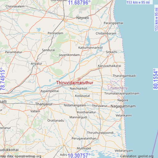
Thiruvidaimaruthur GPS coordinates[2]
10° 59' 54.852" North, 79° 27' 8.172" East
| Map corner | latitude | longitude |
|---|---|---|
| Upper-left | 11.68796°, | 78.74915° |
| Center: | 10.99857°, | 79.45227° |
| Lower-right: | 10.30757°, | 80.1554° |
| Map W x H: | 153.5×153.5 km | = 95.4×95.4mi |
| max Lat: | 34.9274° ⇑93.2% North |
| Thiruvidaimaruthur: | 10.99857° |
| min Lat: | ⇓6.8% South 8.09008° |
| min Long | Thiruvidaimarut | max Long |
| 68.82655° | 79.45227° | 96.81° |
| W 63.3%⇐ | ⇒36.7% E |
Elevation
Elevation of Thiruvidaimaruthur is 29 m = 95 ft, and this is 266.6 m = 875 ft below average elevation for this country.
| Max E: |
3681 m = 12077 ft | 85.5% |
| Avg. | 295.6 m = 970 ft | |
| Thiruvidaimaruthur | 29 m = 95 ft | |
Min E: |
1 m = 3 ft | 14.5% |
See also: India elevation on elevation.city.
Geographical zone
Thiruvidaimaruthur is located in North Torrid zone (between Equator and Tropic of Cancer). Distance of Equator is 1222.9 km =759.9 mi to South.| Distance of | km | miles | from Thiruvidaimaruthur |
|---|---|---|---|
| North Pole | 8784.1 | 5458.2 | to North |
| Arctic Circle | 6178.2 | 3839 | to North |
| Tropic Cancer | 1383 | 859.4 | to North |
| Equator | 1222.9 | 759.9 | to South |


Nearby cities:
15 places around Thiruvidaimaruthur: (largest is in red/bold)
• Aduthurai
3.6 km =2.2 mi,  59°
59°
• Ammāpettai
26.9 km =16.7 mi,  212°
212°
• Ayyampettāi
31.6 km =19.6 mi,  250°
250°
• Jayamkondacholapuram
25.7 km =16 mi,  337°
337°
• Koothanallur
31.7 km =19.7 mi,  167°
167°
• Koradāchcheri
25.8 km =16 mi, 170°
• Kumbakonam
7.8 km =4.8 mi,  238°
238°
• Mannargudi
36.9 km =22.9 mi,  180°
180°
• Mayiladuthurai
25 km =15.5 mi, 62°
• Nannilam
21.8 km =13.5 mi,  127°
127°
• Needamangalam
25.3 km =15.7 mi,  188°
188°
• Papanasam
21.4 km =13.3 mi, 248°
• Swāmimalai
14.2 km =8.8 mi, 251°
• Thiruvarur
32.2 km =20 mi,  141°
141°
• Valangaiman
13.7 km =8.5 mi, 208°
Sources, notices
• [Note1] Compared only with cities in India existing in our database
• [Src1] Map data: © OpenStreetMap contributors (CC-BY-SA)
• [Src2] Other city data from geonames.org with taken over terms of usage.
• [Src3] Geographical zone / Annual Mean Temperature by Robert A. Rohde @ Wikipedia
