Gobindpur geodata
Gobindpur (Jharkhand) is a populated place; located in India in Asia/Kolkata (GMT+5.5) time zone. With population of 9,507 people, there are 2993 cities with bigger population in this country. Compared to other cities in India, 57.1% of cities are located further ↓South; 88.3% of cities are located further ←West and 51.7% of cities have lower elevation than Gobindpur. Note1


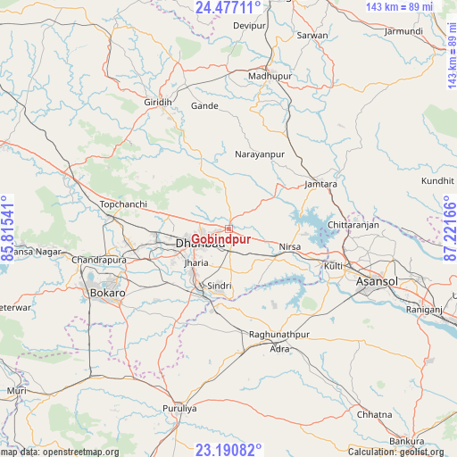
Gobindpur GPS coordinates[2]
23° 50' 8.016" North, 86° 31' 6.708" East
| Map corner | latitude | longitude |
|---|---|---|
| Upper-left | 24.47711°, | 85.81541° |
| Center: | 23.83556°, | 86.51853° |
| Lower-right: | 23.19082°, | 87.22166° |
| Map W x H: | 143×143 km | = 88.9×88.9mi |
| max Lat: | 34.9274° ⇑42.9% North |
| Gobindpur: | 23.83556° |
| min Lat: | ⇓57.1% South 8.09008° |
| min Long | Gobindpur | max Long |
| 68.82655° | 86.51853° | 96.81° |
| W 88.3%⇐ | ⇒11.7% E |
Elevation
Elevation of Gobindpur is 212 m = 696 ft, and this is 83.6 m = 274 ft below average elevation for this country.
| Max E: |
3681 m = 12077 ft | 48.3% |
| Avg. | 295.6 m = 970 ft | |
| Gobindpur | 212 m = 696 ft | |
Min E: |
1 m = 3 ft | 51.7% |
See also: India elevation on elevation.city.
Geographical zone
Gobindpur is located in North temperate zone (between Tropic of Cancer and the Arctic Circle). Distance of this Northern Tropic circle is 44.3 km =27.5 mi to South.| Distance of | km | miles | from Gobindpur |
|---|---|---|---|
| North Pole | 7356.8 | 4571.3 | to North |
| Arctic Circle | 4750.9 | 2952.1 | to North |
| Tropic Cancer | 44.3 | 27.5 | to South |
| Equator | 2650.3 | 1646.8 | to South |


Nearby cities:
15 places around Gobindpur: (largest is in red/bold)
• Bagra
23.5 km =14.6 mi,  241°
241°
• Bhojudih
23.2 km =14.4 mi,  199°
199°
• Dhanbād
8.5 km =5.3 mi, 244°
• Jharia
14.9 km =9.3 mi,  225°
225°
• Jāmadoba
17.9 km =11.1 mi,  222°
222°
• Jāmtāra
32.2 km =20 mi,  63°
63°
• Kenduadīh
15.9 km =9.9 mi,  245°
245°
• Kātrās
22.8 km =14.2 mi,  259°
259°
• Lakhyabad
24.1 km =15 mi,  141°
141°
• Malkera
24.2 km =15 mi, 255°
• Mugma
22.5 km =14 mi,  108°
108°
• Nirsā
20 km =12.4 mi, 106°
• Pāthardih
20.8 km =12.9 mi,  205°
205°
• Sijua
20.3 km =12.6 mi, 250°
• Topchānchi
33.5 km =20.8 mi,  283°
283°
Sources, notices
• [Note1] Compared only with cities in India existing in our database
• [Src1] Map data: © OpenStreetMap contributors (CC-BY-SA)
• [Src2] Other city data from geonames.org with taken over terms of usage.
• [Src3] Geographical zone / Annual Mean Temperature by Robert A. Rohde @ Wikipedia
