Jāmtāra geodata
Jāmtāra (Jharkhand) is a populated place; located in India in Asia/Kolkata (GMT+5.5) time zone. With population of 24,388 people, there are 1744 cities with bigger population in this country. Compared to other cities in India, 58% of cities are located further ↓South; 88.9% of cities are located further ←West and 50.5% of cities have higher elevation than Jāmtāra. Note1


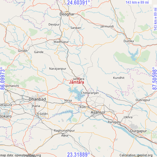
Jāmtāra GPS coordinates[2]
23° 57' 46.8" North, 86° 48' 10.26" East
| Map corner | latitude | longitude |
|---|---|---|
| Upper-left | 24.60391°, | 86.09973° |
| Center: | 23.963°, | 86.80285° |
| Lower-right: | 23.31889°, | 87.50598° |
| Map W x H: | 142.9×142.9 km | = 88.8×88.8mi |
| max Lat: | 34.9274° ⇑42% North |
| Jāmtāra: | 23.963° |
| min Lat: | ⇓58% South 8.09008° |
| min Long | Jāmtāra | max Long |
| 68.82655° | 86.80285° | 96.81° |
| W 88.9%⇐ | ⇒11.1% E |
Elevation
Elevation of Jāmtāra is 199 m = 653 ft, and this is 96.6 m = 317 ft below average elevation for this country.
| Max E: |
3681 m = 12077 ft | 50.5% |
| Avg. | 295.6 m = 970 ft | |
| Jāmtāra | 199 m = 653 ft | |
Min E: |
1 m = 3 ft | 49.5% |
See also: India elevation on elevation.city.
Geographical zone
Jāmtāra is located in North temperate zone (between Tropic of Cancer and the Arctic Circle). Distance of this Northern Tropic circle is 58.5 km =36.4 mi to South.| Distance of | km | miles | from Jāmtāra |
|---|---|---|---|
| North Pole | 7342.6 | 4562.5 | to North |
| Arctic Circle | 4736.7 | 2943.2 | to North |
| Tropic Cancer | 58.5 | 36.4 | to South |
| Equator | 2664.4 | 1655.6 | to South |


Nearby cities:
15 places around Jāmtāra: (largest is in red/bold)
• Chittaranjan
15.6 km =9.7 mi,  139°
139°
• Dhanbād
40.7 km =25.3 mi,  243°
243°
• Gobindpur
32.2 km =20 mi, 243°
• Jharia
46.6 km =29 mi, 237°
• Jāmadoba
49.3 km =30.6 mi, 236°
• Jāmuria
40.2 km =25 mi, 135°
• Kenduadīh
48.1 km =29.9 mi, 244°
• Kulti
26.1 km =16.2 mi,  170°
170°
• Lakhyabad
35.7 km =22.2 mi,  202°
202°
• Madhupur
38.4 km =23.9 mi,  334°
334°
• Mugma
22.8 km =14.2 mi, 199°
• Nirsā
22.1 km =13.7 mi,  206°
206°
• Pāthardih
50.2 km =31.2 mi,  228°
228°
• Raghunathpur
49 km =30.4 mi, 195°
• Āsansol
36.1 km =22.4 mi,  149°
149°
Sources, notices
• [Note1] Compared only with cities in India existing in our database
• [Src1] Map data: © OpenStreetMap contributors (CC-BY-SA)
• [Src2] Other city data from geonames.org with taken over terms of usage.
• [Src3] Geographical zone / Annual Mean Temperature by Robert A. Rohde @ Wikipedia
