Villanovaforru geodata
Villanovaforru (Sardinia) is a seat of a third-order administrative division; located in Italy in Europe/Rome (GMT+2) time zone. With population of 674 people, there are 8461 cities with bigger population in this country. Compared to other cities in Italy, 89.7% of cities are located further ↑North; 83.3% of cities are located further →East and 60.9% of cities have lower elevation than Villanovaforru. Note1
Administrative division(s):
- Level 1: Sardinia
- Level 2: Provincia del Sud Sardegna
- Level 3: Villanovaforru


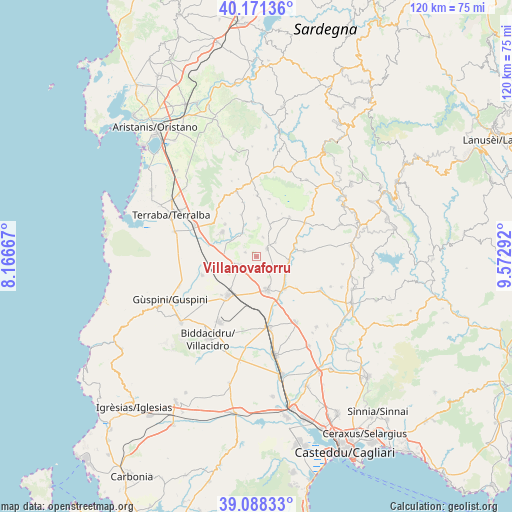
Villanovaforru GPS coordinates[2]
39° 37' 55.056" North, 8° 52' 11.244" East
| Map corner | latitude | longitude |
|---|---|---|
| Upper-left | 40.17136°, | 8.16667° |
| Center: | 39.63196°, | 8.86979° |
| Lower-right: | 39.08833°, | 9.57292° |
| Map W x H: | 120.4×120.4 km | = 74.8×74.8mi |
| max Lat: | 47.04031° ⇑89.7% North |
| Villanovaforru: | 39.63196° |
| min Lat: | ⇓10.3% South 35.50142° |
| min Long | Villanovaforru | max Long |
| 6.69888° | 8.86979° | 18.48682° |
| W 16.7%⇐ | ⇒83.3% E |
Elevation
Elevation of Villanovaforru is 306 m = 1004 ft, and this is 0.69999999999999 m = 2 ft below average elevation for this country.
| Max E: |
2085 m = 6841 ft | 39.1% |
| Avg. | 306.7 m = 1006 ft | |
| Villanovaforru | 306 m = 1004 ft | |
Min E: |
-4 m = -13 ft | 60.9% |
See also: Italy elevation on elevation.city.
Geographical zone
Villanovaforru is located in North temperate zone (between Tropic of Cancer and the Arctic Circle). Distance of this Northern Tropic circle is 1800.7 km =1118.9 mi to South.| Distance of | km | miles | from Villanovaforru |
|---|---|---|---|
| North Pole | 5600.4 | 3479.9 | to North |
| Arctic Circle | 2994.5 | 1860.7 | to North |
| Tropic Cancer | 1800.7 | 1118.9 | to South |
| Equator | 4406.7 | 2738.2 | to South |


Nearby cities:
15 places around Villanovaforru: (largest is in red/bold)
• Baradili
10.3 km =6.4 mi,  13°
13°
• Baressa
9 km =5.6 mi,  2°
2°
• Collinas
2.8 km =1.7 mi,  290°
290°
• Furtei
10.2 km =6.3 mi,  139°
139°
• Gonnoscodina
8.1 km =5 mi,  338°
338°
• Gonnostramatza
6.5 km =4 mi,  330°
330°
• Lunamatrona
3.2 km =2 mi,  52°
52°
• Mogoro
9.9 km =6.2 mi,  306°
306°
• Pauli Arbarei
5.6 km =3.5 mi, 53°
• Sanluri
8.2 km =5.1 mi,  161°
161°
• Sardara
4.6 km =2.9 mi,  245°
245°
• Siddi
4.8 km =3 mi,  19°
19°
• Turri
9 km =5.6 mi,  26°
26°
• Ussaramanna
7.5 km =4.7 mi, 26°
• Villamar
7.8 km =4.8 mi,  100°
100°
Sources, notices
• [Note1] Compared only with cities in Italy existing in our database
• [Src1] Map data: © OpenStreetMap contributors (CC-BY-SA)
• [Src2] Other city data from geonames.org with taken over terms of usage.
• [Src3] Geographical zone / Annual Mean Temperature by Robert A. Rohde @ Wikipedia
