Villafranca Tirrena geodata
Villafranca Tirrena (Sicily) is a seat of a third-order administrative division; located in Italy in Europe/Rome (GMT+2) time zone. With population of 8,124 people, there are 1193 cities with bigger population in this country. Compared to other cities in Italy, 94.8% of cities are located further ↑North; 90.4% of cities are located further ←West and 87.8% of cities have higher elevation than Villafranca Tirrena. Note1


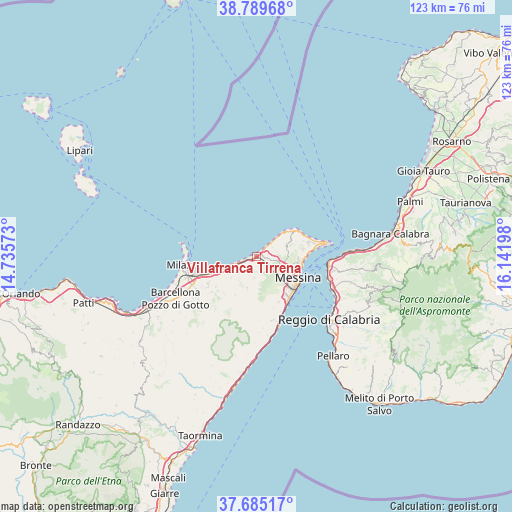
Villafranca Tirrena GPS coordinates[2]
38° 14' 22.272" North, 15° 26' 19.86" East
| Map corner | latitude | longitude |
|---|---|---|
| Upper-left | 38.78968°, | 14.73573° |
| Center: | 38.23952°, | 15.43885° |
| Lower-right: | 37.68517°, | 16.14198° |
| Map W x H: | 122.8×122.8 km | = 76.3×76.3mi |
| max Lat: | 47.04031° ⇑94.8% North |
| Villafranca Tirrena: | 38.23952° |
| min Lat: | ⇓5.2% South 35.50142° |
| min Long | Villafranca Tir | max Long |
| 6.69888° | 15.43885° | 18.48682° |
| W 90.4%⇐ | ⇒9.6% E |
Elevation
Elevation of Villafranca Tirrena is 23 m = 75 ft, and this is 283.7 m = 931 ft below average elevation for this country.
| Max E: |
2085 m = 6841 ft | 87.8% |
| Avg. | 306.7 m = 1006 ft | |
| Villafranca Tirrena | 23 m = 75 ft | |
Min E: |
-4 m = -13 ft | 12.2% |
See also: Italy elevation on elevation.city.
Geographical zone
Villafranca Tirrena is located in North temperate zone (between Tropic of Cancer and the Arctic Circle). Distance of this Northern Tropic circle is 1645.9 km =1022.7 mi to South.| Distance of | km | miles | from Villafranca Tirrena |
|---|---|---|---|
| North Pole | 5755.2 | 3576.1 | to North |
| Arctic Circle | 3149.3 | 1956.9 | to North |
| Tropic Cancer | 1645.9 | 1022.7 | to South |
| Equator | 4251.8 | 2641.9 | to South |


Nearby cities:
15 places around Villafranca Tirrena: (largest is in red/bold)
• Castanea delle Furie
7.6 km =4.7 mi,  71°
71°
• Fondachello
7.7 km =4.8 mi,  250°
250°
• Gesso
2.6 km =1.6 mi,  100°
100°
• Roccavaldina
8.5 km =5.3 mi,  222°
222°
• Rodia-S.saba
5.5 km =3.4 mi,  47°
47°
• Rometta
8 km =5 mi,  195°
195°
• Rometta Marea
2.7 km =1.7 mi, 253°
• Salice
5.1 km =3.2 mi,  76°
76°
• Saponara
5.3 km =3.3 mi,  184°
184°
• Saponara Marittima
1.4 km =0.9 mi,  230°
230°
• Scarcelli
3.9 km =2.4 mi,  189°
189°
• Spadafora
5.3 km =3.3 mi, 250°
• Valdina
7.9 km =4.9 mi, 229°
• Venetico Marina
6.7 km =4.2 mi, 250°
• Venetico Superiore
7.2 km =4.5 mi, 224°
Sources, notices
• [Note1] Compared only with cities in Italy existing in our database
• [Src1] Map data: © OpenStreetMap contributors (CC-BY-SA)
• [Src2] Other city data from geonames.org with taken over terms of usage.
• [Src3] Geographical zone / Annual Mean Temperature by Robert A. Rohde @ Wikipedia
