San Vincenzo la Costa geodata
San Vincenzo la Costa (Calabria) is a seat of a third-order administrative division; located in Italy in Europe/Rome (GMT+2) time zone. With population of 684 people, there are 8395 cities with bigger population in this country. Compared to other cities in Italy, 90.9% of cities are located further ↑North; 94% of cities are located further ←West and 76.8% of cities have lower elevation than San Vincenzo la Costa. Note1
Administrative division(s):
- Level 1: Calabria
- Level 2: Provincia di Cosenza
- Level 3: San Vincenzo la Costa
Current local time in San Vincenzo la Costa:
11:17 PM, WednesdayDifference from your time zone: hours


San Vincenzo la Costa GPS coordinates[2]
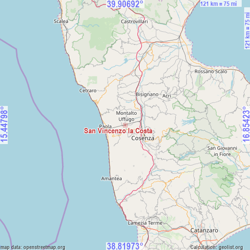
39° 21' 55.584" North, 16° 9' 3.96" East
| Map corner | latitude | longitude |
|---|---|---|
| Upper-left | 39.90692°, | 15.44798° |
| Center: | 39.36544°, | 16.1511° |
| Lower-right: | 38.81973°, | 16.85423° |
| Map W x H: | 120.9×120.9 km | = 75.1×75.1mi |
| max Lat: | 47.04031° ⇑90.9% North |
| San Vincenzo la Costa: | 39.36544° |
| min Lat: | ⇓9.1% South 35.50142° |
| min Long | San Vincenzo la | max Long |
| 6.69888° | 16.1511° | 18.48682° |
| W 94%⇐ | ⇒6% E |
Elevation
Elevation of San Vincenzo la Costa is 477 m = 1565 ft, and this is 170.3 m = 559 ft above average elevation for this country.
| Max E: |
2085 m = 6841 ft | 23.2% |
| San Vincenzo la Costa | 477 m 1565 ft | |
| Avg. | 306.7 m = 1006 ft | |
Min E: |
-4 m = -13 ft | 76.8% |
See also: Italy elevation on elevation.city.
Geographical zone
San Vincenzo la Costa is located in North temperate zone (between Tropic of Cancer and the Arctic Circle). Distance of this Northern Tropic circle is 1771.1 km =1100.5 mi to South.| Distance of | km | miles | from San Vincenzo la Costa |
|---|---|---|---|
| North Pole | 5630 | 3498.3 | to North |
| Arctic Circle | 3024.1 | 1879.1 | to North |
| Tropic Cancer | 1771.1 | 1100.5 | to South |
| Equator | 4377 | 2719.7 | to South |


Nearby cities:
15 places around San Vincenzo la Costa: (largest is in red/bold)
• Amendola
2.7 km =1.7 mi,  206°
206°
• Arcavacata
5 km =3.1 mi,  98°
98°
• Bucita
2.6 km =1.6 mi,  219°
219°
• Castrolibero
7.2 km =4.5 mi,  148°
148°
• Marano Marchesato
6.2 km =3.9 mi,  161°
161°
• Montalto Uffugo
4.2 km =2.6 mi,  4°
4°
• Ortomatera
7.1 km =4.4 mi,  129°
129°
• Quattromiglia
7.8 km =4.8 mi,  107°
107°
• Rende
4.5 km =2.8 mi, 146°
• Salerni
7.1 km =4.4 mi,  69°
69°
• San Benedetto Ullano
7.2 km =4.5 mi,  341°
341°
• San Fili
2.9 km =1.8 mi,  191°
191°
• Santa Maria di Settimo
4.5 km =2.8 mi, 74°
• Santo Stefano
4.6 km =2.9 mi,  116°
116°
• Surdo
6 km =3.7 mi, 134°
Sources, notices
• [Note1] Compared only with cities in Italy existing in our database
• [Src1] Map data: © OpenStreetMap contributors (CC-BY-SA)
• [Src2] Other city data from geonames.org with taken over terms of usage.
• [Src3] Geographical zone / Annual Mean Temperature by Robert A. Rohde @ Wikipedia
