Rossano geodata
Rossano (Calabria) is a seat of a third-order administrative division; located in Italy in Europe/Rome (GMT+2) time zone. With population of 5,194 people, there are 1879 cities with bigger population in this country. Compared to other cities in Italy, 90% of cities are located further ↑North; 97.1% of cities are located further ←West and 55.9% of cities have lower elevation than Rossano. Note1
Administrative division(s):
- Level 1: Calabria
- Level 2: Provincia di Cosenza
- Level 3: Corigliano-Rossano


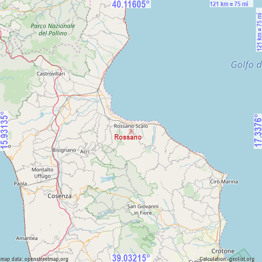
Rossano GPS coordinates[2]
39° 34' 34.392" North, 16° 38' 4.092" East
| Map corner | latitude | longitude |
|---|---|---|
| Upper-left | 40.11605°, | 15.93135° |
| Center: | 39.57622°, | 16.63447° |
| Lower-right: | 39.03215°, | 17.3376° |
| Map W x H: | 120.5×120.5 km | = 74.9×74.9mi |
| max Lat: | 47.04031° ⇑90% North |
| Rossano: | 39.57622° |
| min Lat: | ⇓10% South 35.50142° |
| min Long | Rossano | max Long |
| 6.69888° | 16.63447° | 18.48682° |
| W 97.1%⇐ | ⇒2.9% E |
Elevation
Elevation of Rossano is 271 m = 889 ft, and this is 35.7 m = 117 ft below average elevation for this country.
| Max E: |
2085 m = 6841 ft | 44.1% |
| Avg. | 306.7 m = 1006 ft | |
| Rossano | 271 m = 889 ft | |
Min E: |
-4 m = -13 ft | 55.9% |
See also: Italy elevation on elevation.city.
Geographical zone
Rossano is located in North temperate zone (between Tropic of Cancer and the Arctic Circle). Distance of this Northern Tropic circle is 1794.5 km =1115.1 mi to South.| Distance of | km | miles | from Rossano |
|---|---|---|---|
| North Pole | 5606.6 | 3483.8 | to North |
| Arctic Circle | 3000.7 | 1864.5 | to North |
| Tropic Cancer | 1794.5 | 1115.1 | to South |
| Equator | 4400.5 | 2734.3 | to South |


Nearby cities:
15 places around Rossano: (largest is in red/bold)
• Amica
3.9 km =2.4 mi,  45°
45°
• Caloppezzati
14.4 km =8.9 mi,  96°
96°
• Caloveto
13.3 km =8.3 mi,  125°
125°
• Corigliano Calabro
10.1 km =6.3 mi,  282°
282°
• Corigliano Scalo
11.8 km =7.3 mi,  298°
298°
• Cropalati
10.3 km =6.4 mi, 129°
• Crosia
11.8 km =7.3 mi,  94°
94°
• Destro
10.9 km =6.8 mi,  152°
152°
• Fabrizio
9.7 km =6 mi,  316°
316°
• Foresta
11.9 km =7.4 mi,  263°
263°
• Marina di Schiavonea
11.9 km =7.4 mi,  313°
313°
• Mirto
12.3 km =7.6 mi,  77°
77°
• Paludi
6.5 km =4 mi,  143°
143°
• Piragineti
6.4 km =4 mi, 305°
• Rossano Stazione
2.5 km =1.6 mi,  0°
0°
Sources, notices
• [Note1] Compared only with cities in Italy existing in our database
• [Src1] Map data: © OpenStreetMap contributors (CC-BY-SA)
• [Src2] Other city data from geonames.org with taken over terms of usage.
• [Src3] Geographical zone / Annual Mean Temperature by Robert A. Rohde @ Wikipedia
