Mirto geodata
Mirto (Calabria) is a populated place; located in Italy in Europe/Rome (GMT+2) time zone. With population of 8,684 people, there are 1099 cities with bigger population in this country. Compared to other cities in Italy, 89.9% of cities are located further ↑North; 97.5% of cities are located further ←West and 76.1% of cities have higher elevation than Mirto. Note1


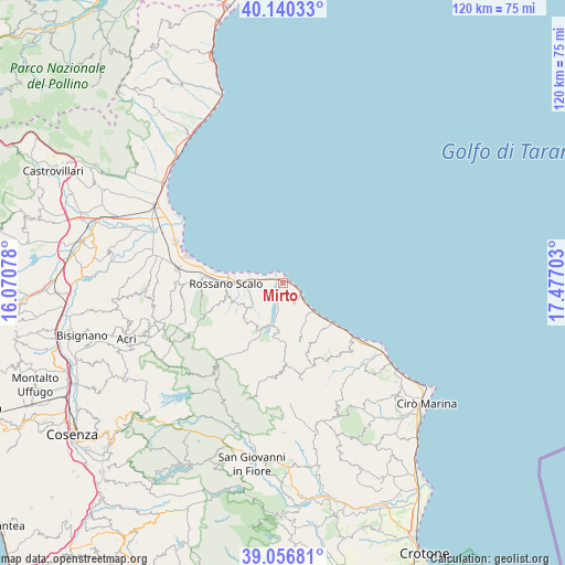
Mirto GPS coordinates[2]
39° 36' 2.484" North, 16° 46' 26.04" East
| Map corner | latitude | longitude |
|---|---|---|
| Upper-left | 40.14033°, | 16.07078° |
| Center: | 39.60069°, | 16.7739° |
| Lower-right: | 39.05681°, | 17.47703° |
| Map W x H: | 120.5×120.5 km | = 74.9×74.9mi |
| max Lat: | 47.04031° ⇑89.9% North |
| Mirto: | 39.60069° |
| min Lat: | ⇓10.1% South 35.50142° |
| min Long | Mirto | max Long |
| 6.69888° | 16.7739° | 18.48682° |
| W 97.5%⇐ | ⇒2.5% E |
Elevation
Elevation of Mirto is 69 m = 226 ft, and this is 237.7 m = 780 ft below average elevation for this country.
| Max E: |
2085 m = 6841 ft | 76.1% |
| Avg. | 306.7 m = 1006 ft | |
| Mirto | 69 m = 226 ft | |
Min E: |
-4 m = -13 ft | 23.9% |
See also: Italy elevation on elevation.city.
Geographical zone
Mirto is located in North temperate zone (between Tropic of Cancer and the Arctic Circle). Distance of this Northern Tropic circle is 1797.3 km =1116.8 mi to South.| Distance of | km | miles | from Mirto |
|---|---|---|---|
| North Pole | 5603.9 | 3482.1 | to North |
| Arctic Circle | 2998 | 1862.9 | to North |
| Tropic Cancer | 1797.3 | 1116.8 | to South |
| Equator | 4403.2 | 2736 | to South |


Nearby cities:
15 places around Mirto: (largest is in red/bold)
• Amica
9.2 km =5.7 mi,  270°
270°
• Caloppezzati
5 km =3.1 mi,  151°
151°
• Caloveto
10.5 km =6.5 mi,  186°
186°
• Camigliano
9 km =5.6 mi,  132°
132°
• Cropalati
10.2 km =6.3 mi,  203°
203°
• Crosia
3.6 km =2.2 mi,  183°
183°
• Destro
14.2 km =8.8 mi,  208°
208°
• Fabrizio
19.1 km =11.9 mi,  283°
283°
• Mandatoriccio
15.8 km =9.8 mi,  160°
160°
• Paludi
11.3 km =7 mi,  225°
225°
• Pietrapaola
13.1 km =8.1 mi, 164°
• Piragineti
17.2 km =10.7 mi, 273°
• Rossano
12.3 km =7.6 mi,  257°
257°
• Rossano Stazione
11.9 km =7.4 mi, 268°
• San Giacomo-Marinella
5.1 km =3.2 mi, 126°
Sources, notices
• [Note1] Compared only with cities in Italy existing in our database
• [Src1] Map data: © OpenStreetMap contributors (CC-BY-SA)
• [Src2] Other city data from geonames.org with taken over terms of usage.
• [Src3] Geographical zone / Annual Mean Temperature by Robert A. Rohde @ Wikipedia
