Fabrizio geodata
Fabrizio (Calabria) is a populated place; located in Italy in Europe/Rome (GMT+2) time zone. With population of 2,172 people, there are 3906 cities with bigger population in this country. Compared to other cities in Italy, 89.7% of cities are located further ↑North; 96.8% of cities are located further ←West and 97.2% of cities have higher elevation than Fabrizio. Note1
Administrative division(s):
- Level 1: Calabria
- Level 2: Provincia di Cosenza
- Level 3: Corigliano-Rossano


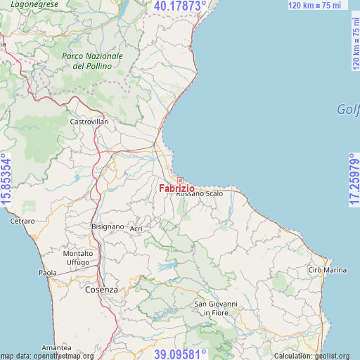
Fabrizio GPS coordinates[2]
39° 38' 21.804" North, 16° 33' 23.976" East
| Map corner | latitude | longitude |
|---|---|---|
| Upper-left | 40.17873°, | 15.85354° |
| Center: | 39.63939°, | 16.55666° |
| Lower-right: | 39.09581°, | 17.25979° |
| Map W x H: | 120.4×120.4 km | = 74.8×74.8mi |
| max Lat: | 47.04031° ⇑89.7% North |
| Fabrizio: | 39.63939° |
| min Lat: | ⇓10.3% South 35.50142° |
| min Long | Fabrizio | max Long |
| 6.69888° | 16.55666° | 18.48682° |
| W 96.8%⇐ | ⇒3.2% E |
Elevation
Elevation of Fabrizio is 5 m = 16 ft, and this is 301.7 m = 990 ft below average elevation for this country.
| Max E: |
2085 m = 6841 ft | 97.2% |
| Avg. | 306.7 m = 1006 ft | |
| Fabrizio | 5 m = 16 ft | |
Min E: |
-4 m = -13 ft | 2.8% |
See also: Italy elevation on elevation.city.
Geographical zone
Fabrizio is located in North temperate zone (between Tropic of Cancer and the Arctic Circle). Distance of this Northern Tropic circle is 1801.6 km =1119.5 mi to South.| Distance of | km | miles | from Fabrizio |
|---|---|---|---|
| North Pole | 5599.6 | 3479.4 | to North |
| Arctic Circle | 2993.7 | 1860.2 | to North |
| Tropic Cancer | 1801.6 | 1119.5 | to South |
| Equator | 4407.5 | 2738.7 | to South |


Nearby cities:
15 places around Fabrizio: (largest is in red/bold)
• Amica
10.4 km =6.5 mi,  114°
114°
• Apollinara
13.8 km =8.6 mi,  299°
299°
• Cantinella
9.6 km =6 mi,  286°
286°
• Chimento
12.1 km =7.5 mi,  223°
223°
• Corigliano Calabro
5.8 km =3.6 mi,  213°
213°
• Corigliano Scalo
3.9 km =2.4 mi,  249°
249°
• Foresta
9.8 km =6.1 mi, 211°
• Marina di Schiavonea
2.3 km =1.4 mi, 300°
• Piragineti
3.6 km =2.2 mi,  155°
155°
• Rossano
9.7 km =6 mi,  136°
136°
• Rossano Stazione
8.1 km =5 mi,  124°
124°
• San Cosmo Albanese
13.7 km =8.5 mi,  242°
242°
• San Giorgio Albanese
10.9 km =6.8 mi,  234°
234°
• San Nico
11.2 km =7 mi, 287°
• Vaccarizzo Albanese
12.2 km =7.6 mi, 240°
Sources, notices
• [Note1] Compared only with cities in Italy existing in our database
• [Src1] Map data: © OpenStreetMap contributors (CC-BY-SA)
• [Src2] Other city data from geonames.org with taken over terms of usage.
• [Src3] Geographical zone / Annual Mean Temperature by Robert A. Rohde @ Wikipedia
